-
 Finalising a programme to fix Auckland's transport is still some way off.
 -
 Fuel costs vary wildly depending on a number of factors, including your driving habits.
"Where is he?”
“In the garden,” I inform my wife.
My son’s very first steps introduce him to a world of new sensory experiences. His newfound ability to transport himself initiates another phase of lifelong growth and development – until he lands face-down in the flower bed.
Walking was our first form of transportation. How fast and how far we walked determined our lifestyle: where we foraged and found shelter, what language we spoke and which customs we followed.
The tribesmen who walked the furthest found the most exotic wives; a bride from another village had to learn the language and customs of her husband’s village. Venturing further broadened horizons. Tracks formed by many feet wove naturally around landforms.
When horses were used for transport, first on their own, then pulling a cart, tracks widened.
Many wheel rotations later, trains surpassed horses and carts. Trains went in straight lines – more or less – and so began a reshaping of the earth’s landforms through dynamite and toil and, later, industrialised machinery. Railways grew above ground, over rivers and under seas while cities were criss-crossed underground by tunnels.
As factories emerged on the outskirts of industrialised cities, bicycles allowed workers to commute previously impossible distances. And, of course, private motor vehicles increased mobility. Cars represented freedom, independence and economic empowerment.
Advertising linked cars with fashion, status and lifestyle and defined the people who drove them. The car became culture – and cities car-centric. Roads and motorways were developed, then expanded. Cars made supermarkets and shopping malls possible. Groceries could arrive home by the boot-load and last a week, rather than smaller, more frequent handheld loads from local stores. The car allowed dwellings to spread to rural areas – the start of urban sprawl – and, in our country, enabling the ‘quarter-acre block’ lifestyle.
Between us, the seven billion people on the planet today own one billion cars – all looking for a parking space.
Houses gained first single, then double garages. In many cities, the popularity of the cars slowed traffic to a frustrating crawl. Planners countered with more roads: wider, straighter, faster. The continuing inefficiency caused by congestion, both financial and personal, is enormous. Between us, the seven billion people on the planet today own one billion cars – all looking for a parking space.
In some cities, searching for this elusive rectangle of tarmac burns a third of the petrol used for the journey. Carbon emissions are resulting in climate change effects and big money is being spent to find fuel alternatives. Biofuel researchers are confident they will produce a clean energy liquid as efficient as petroleum, something electric vehicles are currently unable to deliver. 
Yet the future of the car remains promising. Greater automation will boost safety and ease congestion. Motorists can look forward to advanced GPS with 3D maps and live data about road conditions, the most energy efficient route to a destination and where to find that parking space.
At the same time, there is growing awareness of the need for humans to be more active. Mental illness, obesity and diabetes are epidemics sweeping the world; the foundations of physical and mental health are exercise and fresh air – and meeting people.
‘Active transport’ is an important antidote to the trio of epidemics. Cities across the world are addressing these health issues, as well as traffic congestion, by engineering plans around walkers and cyclists.
In Seoul, Korea, a four-lane motorway built in 1969, flanked by high-rise and used by 600,000 cars daily, was demolished in 2005 and replaced with gardens, a stream, walkways and cycleways. Outside the city of Chengdu, China, a prototype development known as the Great City is being built, capable of housing 80,000. It is a modern pedestrian-only city. Planned around a central transit-way with underground rail connections, most amenities are accessible within a 15-minute walk.
Walking and cycling cities require density. Residences are on ‘vertical streets’. Public spaces are gathering areas for spontaneous face-to-face interaction. Cafes, bars and restaurants with easy chairs and coffee tables and open street frontages become ‘living room’ extensions. Bike-friendly public transport is usually close by: no more than a 15-minute walk. As it always has, mobility adapts to changing lifestyles.
Twelve years ago I lived in an eastern suburb of Auckland. From the time I left my street for work, I entered a stop-start traffic queue, arriving at work more than an hour later. We decided to move into a central-city apartment, sold one car, and now use the other to visit family and friends in the suburbs and for trips out of Auckland. I purchased an electric bike. Now Auckland’s hills are managed with a grin.
In the evenings we stroll through the nearby park on our way to a café. I walk to work: ten minutes each way. With extra time to enjoy, I meet neighbours, walk to the library, art gallery or movies, or chat with friends at inner-city bars.
I can write for offshore magazines from a small desk in my bedroom. I can study at the world’s best universities without leaving home.
Yes, the vast majority of Aucklanders (87%) don’t work in the centre of the city and their mobility solutions are very different to mine. But mobile technology invites us to live more flexible lifestyles, to work and learn in a variety of locations, to restructure school systems, while taking advantage of the global information network.
Modern transportation lets us enter into the life, language and thoughts of others...
We can connect without the commute. We have gone far beyond the limitations of our feet. Modern transportation lets us enter into the life, language and thoughts of others, sewing seeds for greater unity.
Transport allows us to experience, first hand, architectural masterpieces and great works of art and to listen to every kind of music. Transport affects our health, economy, the natural environment and how we plan our cities. Without access to transport that shifts us out of familiar surroundings, we would never reach the flower bed. 
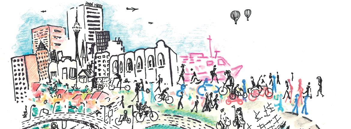
A plan for Auckland
Auckland Council has presented an ultimatum to Aucklanders: get a hot new transport system for an additional $12 billion ($300 million every year for the next 30 years) or expect traffic congestion for a long, long time.
In reality, the situation is a lot less simple than that. Congestion is going to get worse even if Auckland does opt to pay more and the new ways of paying for infrastructure being proposed by the Council (like motorway tolls or tax fuels) would need support from a sceptical central Government. So finalising a programme to fix Auckland's transport is still some way off.
Meanwhile, Aucklanders can look forward to a number of projects that will reshape the mobility landscape. According to Auckland Transport's plan for the city, new train stations will be the ‘queen bees’ in the hive: centred in areas that are growing as residential hot spots, into which other transport options will feed. The City Rail Link will extend from Britomart and include two additional stations: Aotea and Karangahape, and an upgraded Mt Eden Station. Making Britomart a through-station means rail capacity will double, reducing travel times.
It's expected that the share of CBD commuters travelling by rail will increase from around eight percent to 20%. The project will take five and a half years to build and cost $2.4 billion.
The possibility of a light rail system has also been mooted. The bus network is changing from a ‘coverage model’ to a ‘frequency model’. What does this mean? You can expect a bus to arrive at your stop more frequently – at least one every 15 minutes. But the network won’t cover the same amount of geography. You may end up walking or cycling 20 minutes to get to your closest stop. There will be fewer stops in a journey, so you’ll get to your destination quicker. And if you transfer from bus to train to ferry, it all comes under the one ticket and fare.
The Auckland Cycle Network is part of an ambitious plan to get more Aucklanders using active modes of transport, and $15 million per year for the next 15 years will be needed to complete it. Seventy-five percent of trips to work in Auckland are made by car (about one per cent of people currently use bicycles to commute), so getting Aucklanders spinning pedals might be a bit of a challenge. Ensuring cycleways are separated and safe rather than sharing an already busy roadway will go some way to encouraging this.
With Auckland’s challenging geography, electric bikes seem destined to become a vehicle of choice for the new, slimmer, fitter Auckland. (See p.39) SkyPath takes cycling to a new level – over the Auckland Harbour Bridge, in fact. Conceived as a privately funded initiative, SkyPath is a partially covered clip-on with an estimated cost of $35 million and hopes for 780,000 users in the first year. It is sure to have a better chance of ongoing patronage if the rest of Auckland is cycle friendly.
Don’t count on a whole lot of new roads to relieve congestion, aside from the Western Ring Route and Waterview tunnel, currently underway. Auckland is spread out over a narrow isthmus and we’re running out of space.
AA's Principal Advisor, Infrastructure Barney Irvine says: “The reality is we are not going to build many more of those projects. At some stage we will get another harbour crossing and the East-West connections in Onehunga… but it’s not like we are going to continue to find new corridors. There just isn’t the space. It’s about better management of the roads we have got already.”
Another harbour crossing? Serious planning for a tunnel under the Waitemata will start in the next few years, though construction probably won't begin before 2025. The Auckland Plan’s vision is for 45% of Aucklanders to be cycling, walking and using public transport by 2040. This would help to ease congestion and have other side benefits, health in particular.
Transport changes are desperately needed but the strategy has to be right. Until there's a consensus view about what exactly to build and how to pay for it, freeing up the snail trail commute is not going to end. 
Update on Christchurch
Christchurch’s flat geography and stable climate are ideally suited to bikes. With comprehensive cycle networks, the City Council aims to have 11% of commuters cycling by 2041, in line with cities like Copenhagen and Amsterdam. Safe cycleways mean being separated from walkers and motorised traffic – most of the time. CBD traffic will slow to 30km per hour; $70 million will be spent on cycle facilities over the next seven years.
“The people of Christchurch seem to be right behind this approach,” Barney says. “In the central city in particular, officials have done a really good job of responding to the needs of the different transport modes. When the group that wants more public transport and the group wanting more parking are both happy, you know you've got the balance right.”
This balance is essential when it comes to getting growth and investment back into the CBD. Research identified that pre-quake, inner-city Christchurch had lost much of its vitality, with offices achieving low rental and shoppers frequenting suburban malls.
A focus of the city’s rebuild is to return the beating heart to Christchurch CBD. There will be an increase in inner-city density (a model which supports active transport modes) with additional residential dwellings – 150% more than pre-quake. Where there are people there is action: more vibrant retail, higher demand for office spaces, bustling public plazas and dynamic hospitality.
The CBD bus interchange is another strong statement about where Christchurch sees its transport future. By 2041 Christchurch will have gathered an additional 130,000 residents, and 40% of the population will be over 60. Giving people access to effective public transport is vital in off-setting congestion. The bus interchange will operate on a ‘hub and spoke’ model, with the interchange as the central hub and buses approaching from the suburbs along the ‘wheel spokes’ of a frequency network: more buses, more direct, quicker journeys. The interchange will be shrouded in an aesthetically dynamic statement of modern architecture and echo a bustling airport lounge, feeding buses, people and finance into the city's new pulsing heart.
When it comes to roads, the big story in Christchurch is the construction of the new motorways, with the aim of improving access to the CBD, the airport and Lyttelton Port. In the CBD, traffic flows will be enhanced by better management of the four avenues (Bealey, Fitzgerald, Moorhouse and Deans) with the widening of roads and some one-way routes.
Christchurch has embarked on ambitious transport concepts. Cycling and walking, along with public transport are given greater status, practically and philosophically.
Cycling in Hastings
Hastings is on a mission: to have 20% of the city pushing pedals and pounding pavements five years from now. And it's well on the way to achieving this.
With cycleways that link into the wider cycle routes that surround the Hawkes Bay region – a drawcard for already successful cycle tourism – eight per cent of the community has already got onto the saddle (Auckland is just on one per cent, Amsterdam is on 12%).
The initiative was kicked off five years ago after Hastings District Council applied to the New Zealand Transport Agency for funds to set themselves up as a ‘model community’. NZTA describes such communities as 'urban environments which offer cycling and walking as the easiest transport choice'.
Hastings was awarded $4 million. Council reached into its own pocket for an extra $2 million, and, armed with a good deal of political fortitude, embarked on turning Hastings into a pedal-powered/pedestrian town. ‘IWays’ was the brand they gave the new cycleways, which now run 120km through the town.
“We set ourselves three goals,” Hawkes Bay Deputy Mayor Cynthia Bowers says. “The first was to have 20% of short trips (five to seven kilometres) undertaken by cycling or walking by 2020. The other two goals were to increase the perception that cycling was safe and to reduce the crash rate for cyclists.”
To create cycleways required the removal of inner-city carparks and this met with resistance. Council worked through the issues and stuck to its guns.
“There has been an attitude by motorists that they own the road and there has been a reluctance to share. But I think we are over that now,” Cynthia says.
Changes in awareness and attitudes of motorists, and separated cycleways have reduced crash rates between bikes and cars by a whopping 50% and with education, this is likely to improve.
The Bikes in Schools programme, a project of Bike On NZ, which aims to provide all primary school children with the opportunity to cycle regularly, has its origins in Hastings. With additional leisure cycle routes being constructed around the Hawkes Bay area, including the proposal to create a cycleway from Gisborne to Napier along the old railway, cycle tourism is growing – which adds support to cycle commuting.
Chris van Ryn
Case study: Mangere
If you change the way streets and paths are laid out, can you improve the health and wellbeing of the people who live on them? 
That's the question behind 'Future Streets', a transport research project funded by the Ministry of Business, Innovation and Employment, and being rolled out soon in Mangere, South Auckland.
The research team is led by Dr Hamish Mackie, a transport researcher who was inspired by work carried out at Point England in Auckland to make suburban streets more of a public place and less of a race track.
He says while transport professionals often focus on road safety they sometimes overlook (and may even create) other health costs. He wondered if the problems of obesity and type 2 diabetes could be tackled by changing the way streets and paths are structured, to encourage less reliance on cars and enable a more active lifestyle.
The resulting project is a massive joint venture including numerous transport researchers, health researchers, Police, Auckland Transport and the NZTA. But the project has already demonstrated a new way of planning for transport. Instead of the top-down, command approach, where projects are based solely on professional judgement Future Streets has had to make much more use of a customer-led approach, actually asking people what the key issues are and what they want.
“We’ve been at a stand in the Mangere Mall at every Saturday market for four months just talking to people about what they think. We’ve been to schools and meetings and this told us a huge amount about the realities of travel in the area,” Hamish says. The main discovery has been the importance of personal security. “There have been incidents of violence around the area, but you still see people using walkways and routes that have a poor reputation. We need to acknowledge the issues but also understand what can be done to make people feel safe on these routes,” he says.
Making cycling and walking acceptable forms of transport for adults and particularly children means tackling the security issue first. It means opening up places to public view and making active modes seem more attractive rather than dangerous. It also means creating crossings where the flow of traffic doesn’t seem like an impossible barrier.
While the four-year project won’t transform Mangere (it isn’t that big), it is hoped that it will have an effect on how people travel around Mangere. Its findings will provide data for evaluating the effects and ways to implement a scheme that is very different to roading business-as-usual.
If indeed it does find benefits, Hamish says the idea is to make it possible to transplant the techniques to other parts of the city and country.
Peter King
eBikes
Whether it’s Portland, Melbourne or London, one of the biggest growth areas in alternative urban transport is cycling.
There are good reasons for this. For every three cars on New Zealand roads, two have only a driver in them. For every bus, the average number of passengers is around eight. Average trip length is less than ten kilometres and average trip duration is less than half an hour. So there are an awful lot of largely empty vehicle shells taking up road and parking space which cities would prefer not to accommodate.
Tests have found that in most urban areas, over distances of less than 10kms, bikes are faster than cars, simply because they don’t take up space. London even has cycle ambulances, for that reason.
The trouble is, bikes are human-powered and humans aren’t so keen on getting sweaty and don’t like hills or wind much – things that New Zealand, unlike Denmark or the Netherlands, has a lot of.
Enter the eBike: battery-electric powered bicycles that can match traffic speeds regardless of grade or wind. eBikes are one of the fastest growing cycling segments in Europe, the US and China. It's much like a bicycle to ride but with a mild slope or wind behind you wherever you go. It’s easy to maintain speeds equal to average traffic speeds (30km), and to ride up hills with considerably less effort than without assistance.
eBikes are still pretty expensive (around $2,500) but prices are dropping. The main advantage over a car is better traffic speeds and zero parking costs. Some can be folded to use with cars or public transport. But AA Membership surveys have found that the main concerns about eBikes are much the same as they are about bicycles: people want safe, separated cycle paths and lanes to be comfortable using them.
Peter King
Reported by Chris van Ryn and Peter King for our AA Directions Autumn 2024 issue
Other stories you may like AA Directions

Replica Alfa Romeos
Chris van Ryn talks to a talented builder of bespoke Alfa Romeo replica racing cars.