
-
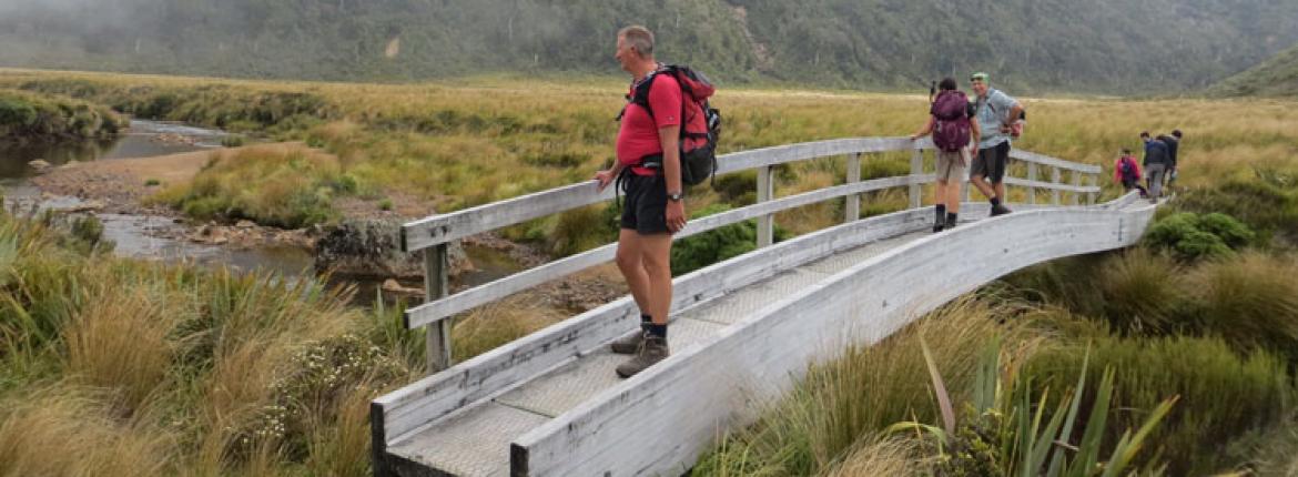 Bridge over the Taranaki swamp
 -
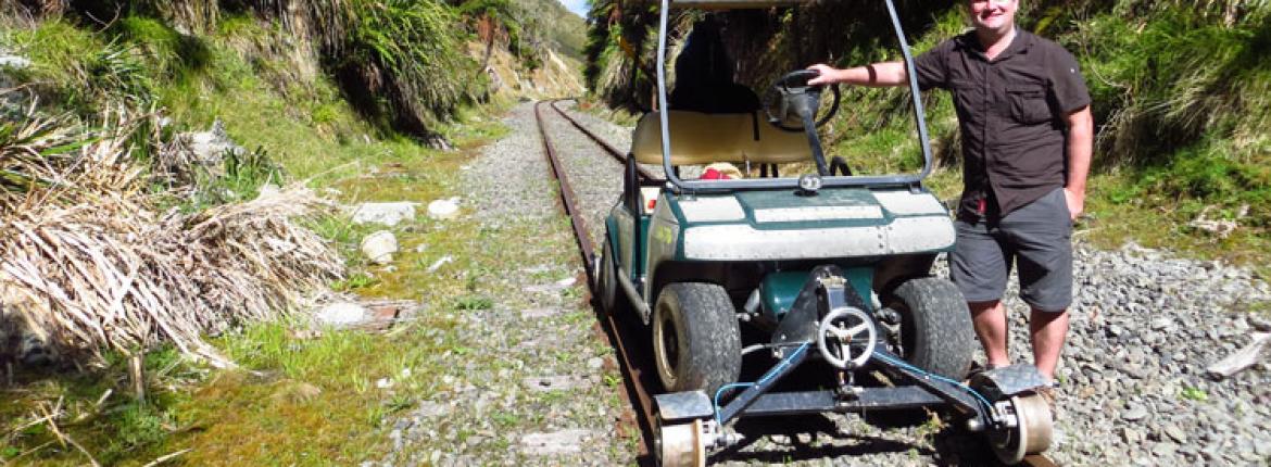 The author with a golf buggy converted for touring on railway tracks.
 -
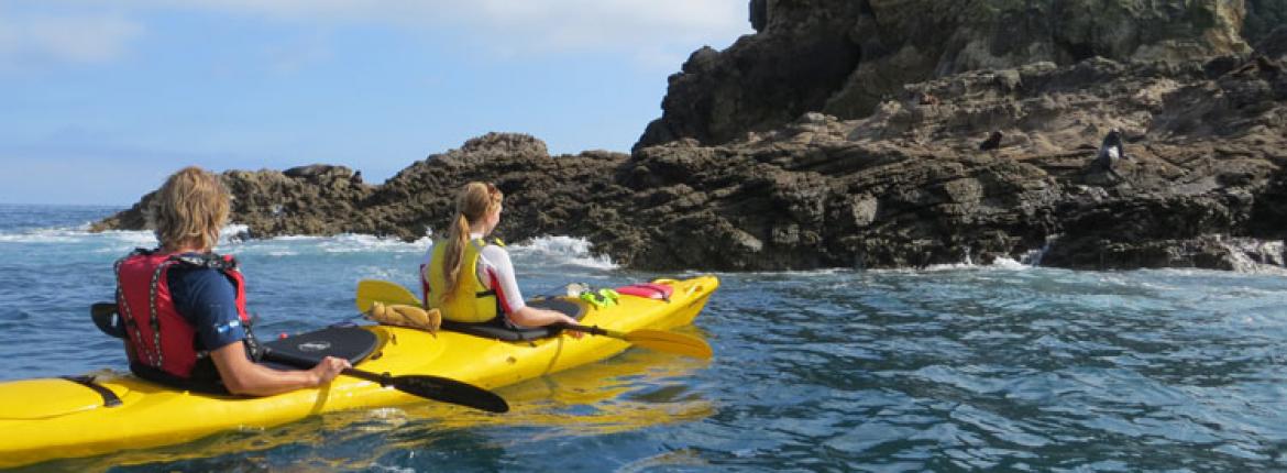 Kayakers approach the Sugar Loaf Islands
Inside the tunnel, a tiny flicker of daylight through the arch in the distance staves off total darkness. Train driving, it turns out, is not for the claustrophobic.
For anyone harbouring long-lingering childhood fantasies of being a train driver, the Stratford to Okahukura line is the closest you’ll get to it without years of tuition. Kiwirail took the line out of service after a derailment in 2009, but an enterprising local farmer has put it to new use.
And that’s how I find myself on a specially adapted golf buggy – it has been fitted with special steel wheels to ensure it stays on the track – driving through dairy country. The buggies trundle along the railway at 20km/h, making that familiar clackety-clack. Sheep scatter, cows just stand and stare. It’s delightfully silly and a glorious way to explore the hilly and forested countryside in the backblocks of eastern Taranaki.
It’s low-drama adventure, with only vague stress at level crossings. But the road running alongside the track is known as the Forgotten World Highway. Most cars seen along the way are parked up, their drivers taking photos of strange golf buggies. After a couple of hours of inane grinning behind the wheel, it’s time to pull over in Whangamomona, the village that declared itself an independent republic in 1989. As we walk into the pub to have a look at the national archive of newspaper clippings, a chap with a huge, scraggly beard walks past. “That’s the president,” says the lady at the bar.
On the way back down the track, the afternoon sun burns away the clouds and brings Mt Taranaki into full view. It really is a stunner, rising as a seemingly-perfect cone above the landscape. But, it has an air of powerful menace about it, which makes me realize the next day’s adventure might not be quite as relaxing and carefree as this day’s has been.
The Pouakai Crossing is the supposedly gentler alternative to conquering Mt Taranaki’s summit – a pitfall-laden trek that gets fit, experienced trampers weeping at its brutality. The Crossing starts in much the same way – up from the North Egmont car park – before diverting across the north face and up into the neighbouring Pouakai Ranges.
Arriving at the car park for sunrise is an extraordinary privilege. Behind is the Tasman Sea and ahead the mighty volcano glows red. Part of Mt Taranaki’s power is that it has so many different looks, depending on your viewing angle and the time of day. The walk begins with a steady uphill plod, with the summit seeming tantalizingly close, yet remaining frustratingly far away. But it starts to get really fascinating after branching right along a track that inches narrowly below towering cliffs. I perch for a while on a rock, just above the cloud line. It’s just me, the mountain and a sprawling horizon.
Part of the joy of the Pouakai Crossing is that you’ll only encounter five or six other people doing it – and that’s if you’re unlucky. It’s a wonderfully contemplative 17km, and it gets even more atmospheric on the descent through skeletal, possum-stripped forest on the way to the Ahukawakawa Swamp. With a bit more marketing savvy, this would be called a wetland, celebrated for its high altitude and range of plants. The Pouakai Range wraps around its golden bowl; the mists roll in with an eerie feel.
The Pouaki Crossing tests the leg muscles; the workout for the arms starts in a kayak on the beach in New Plymouth.
The sun, alas, makes another breakthrough as I attack the two-hour ascent to the Pouakai Hut. This is genuine ‘no pain, no gain’ territory. The views of Taranaki when I stop and turn around are terrific, but there are over 2,000 steps to lumber up. Every corner brings another punishing uphill slog; it’s a gruelling test of fitness and stamina.
When mercy finally materializes, it’s in the shape of a plateau with two tiny lakes. It’s as magically photogenic as I could possibly wish for.
If the Pouakai Crossing tests the leg muscles, then the workout for the arms starts in a kayak on the beach in New Plymouth. If the city gets its good looks from being in the shadow of Mt Taranaki, then the Sugar Loaf Islands are its beauty spots. The remnants of an ancient volcano are just offshore, and have marine reserve status.
Hundreds of fur seals call the islands home. It’s possible to get close to them in a small boat, of course, but the best way to pay a visit is in a kayak.
With the sea calm, it’s a leisurely paddle out. As we get closer to the seals, what looked like tiny specks from the beach become intimidatingly large; being right down at water level provides the best perspective. And the seals aren’t afraid. There are dozens cooling off in the sea, some floating on their backs with flippers in the air, others playing chase under the water’s surface. One takes a keen interest, swimming alongside the kayak before ducking under it and emerging on the other side for a better look.
The seals with the real cute factor, however, are on the islands. The little pups, just feeling their way into the world, are shuffling along the rock. Like the golf buggies, they’re not moving particularly quickly – but they’re adorably memorable.
Reported by David Whitley for our AA Directions Winter 2013 issue
Other stories you may like AA Directions
Road Trip: Queenstown to Christchurch
A journey from Queenstown to Christchurch takes in the unique colour and beauty of the South...

Fine dining at Blue Duck Station, Ruapehu
We visit one of New Zealand’s most remote fine dining restaurants.

Exploring the secret spots of inland Kaikōura
Discover the hidden gems of Kaikōura on a Driftwood Eco Tour.