Aussie road trip: Melbourne to Sydney
03 March 2026
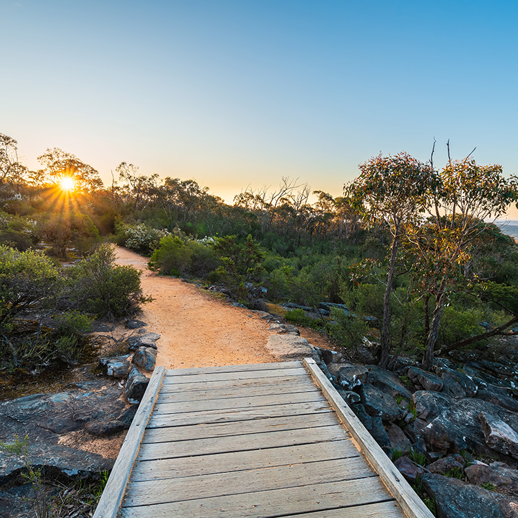
An epic 1,100km drive from Melbourne to Sydney takes in rural Australia, coastal scenery and vibrant cities.

We take a wild four-day, 50km hike on Grampians Peaks Trail in Victoria, Australia.
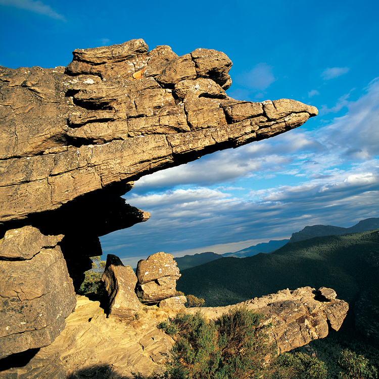
Flat Rock is not flat. Its steep slope is heart-hammering at the start of my four-day expedition on Grampians Peaks Trail. Three hours north-west of Melbourne, the 164km trail takes 13-days to walk, from Mount Zero at the northern end to Dunkeld in the south. I’m walking from Mount Zero to Halls Gap.
I stop for a breather. Beyond cone-shaped Mount Zero, known as Mura Mura by traditional owners, canola fields blaze yellow amidst green plains. Taipan Wall stretches behind us, its striking orange sandstone rockface splattered in white streaks courtesy of Peregrine falcons.
We climb and climb...
A tiny, lilac, wax-lipped orchid blooms from a crevice in the rocky landscape where sweet-smelling mint-bush flowers and clusters of white and red heath myrtle pepper the greenery that grows in little earth. A donkey orchid’s yellow flower resembles two ears. Known as the wildflower garden of Victoria, the Grampians contain one third of the state’s flora, with over 1,000 species. We walk in Petyan, the season of wildflowers and tempestuous weather. It’s one of six seasons recognised by the traditional Jadawadjali and Djab Wurrung owners.
Our Grampians Peaks Walking Co. guide, Kayla, encouragingly declares that most of the climbing is done when we reach swan-like Bird Rock. It towers above me, perched alone on the incline.
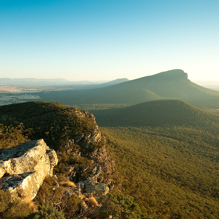
We ascend Mount Stapylton, passing a shallow cave eroded by weather, gigantic fish scale-shapes covering its pale gold ceiling. In blustering wind, I look over the jutting, tilted Grampians. Created by Bunjil, the Great Ancestor Spirit, its traditional name is Gariwerd, meaning pointy mountain range. Other information states ‘Gar’ means nose and ‘werd’ shoulder, signifying the mountain range is made up of the ancestor’s body parts.
According to geologists, the Grampians rose with tectonic action and uplift. Eons ago, the mountains were islands in an ocean.
Grunting sounds halt us. A koala? I peer into treetops but see nothing. Winding through eucalypt bush we come across grasstrees, with brown, velvety spikes heading skywards. They flourish after wildfires. We walk a sandy trail through burnt bush with new foliage and branches sprouting from charred trunks.
A stream traversed, we pass a trickling waterfall and reach Barigar Campsite where tents on wooden platforms are already set up. The site’s rust-orange metal and glass shelter has won an architectural award.
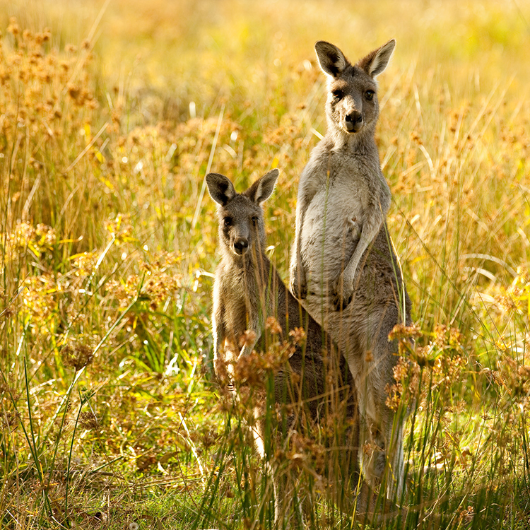
Our group of five are walking by 8am the next day. Heading for Gar campsite, 11.3km away, we come across a eucalypt-dotted, grassy expanse where kangaroos graze, two with joeys in their pouches.
A solid rock climb brings us to a crest. Across a bush-covered valley, at the end of a ridgeline dropping almost regularly at right-angles across the horizon, is Briggs Bluff, our lunch stop. A vertical, yellow slash marks the distant trail.
Knobbly rock gives good foothold, the lumps and striations caused by sea worms which millions of years ago burrowed through the seabed. Wildflowers litter the landscape; soaring sulphur-crested cockatoo screech; frogs croak; an Eastern Banjo Frog calls, ‘bonk, bonk.’
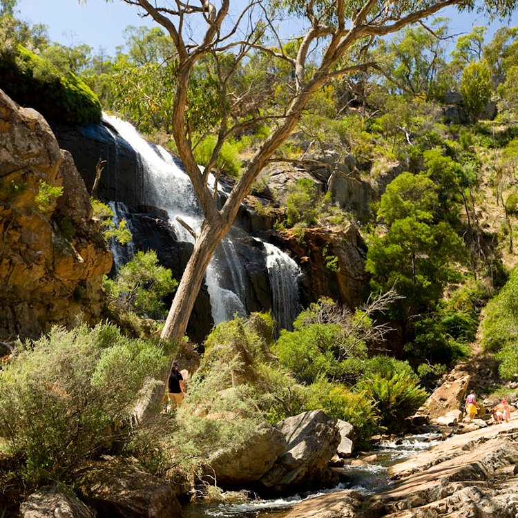
The three waterfalls of Gar spray down orange, yellow and black-streaked cliff faces; the first terraced, the second thinly-layered rock stacked like pancakes, diverging into multiple trickles.
Two and a half hours after viewing it, we’re ascending that yellow slash, a steep climb up smooth rock. Within the immense landscape dotted with flowering shrubs and bare-limbed trees, I’m minute. Steep, chiselled steps lead up between towering rockfaces. We rest at the top. Legs braced against the wind I look over endless green-hued land, punctuated by the human-made reservoir Lake Lonsdale.
Back on the main trail, the way indiscernible but for triangular Grampian Trail markers, relentless ascents continue over solid, tilted rock, endless like a brown, churning sea.
Despite my 12kg pack, the wind knocks me sideways. We reach Gar camp, perched on a wind-torn ridge, six hours after starting out. Our four-bed, glass-fronted huts overlook a green valley far below.
Morning brings low cloud, a howling gale and mist-like rain for the 14km to Werdug. Views come and go; black lichen and rain make for slippery rock in places. From the top of a spine, slate-coloured Lake Werdug appears puddle-sized in the green landscape below.
The sky clears, the wind blasts on. Lake Lonsdale is a slice of distant silver in a multi-green plain. Below the ridgeline we stand upon is Heatherlie Quarry, where rock was sourced to build Melbourne Parliament House.
Coming off a blustery ridge we drop behind a rock face into bush. Sheltered, the temperature is several degrees warmer. Knobbly and bulbous boulders tower; eucalypts creak. An eagle hovers; cockatoos screech. Ascents continue.
Werdug Camp is tucked in eucalypt forest. Views are ‘wow’ from ridgeline huts, encompassing Lake Werdug nestled in a valley hundreds of metres below, surrounded by mountains.
Throughout the night, the wind shakes the hut. Come morning, I step out and am nearly knocked over. We set out in wet weather gear on an undulating trail. Light rain and low cloud means the views, at 829m the highest point on our walk, are a whiteout.
A solitary rock resembles a gigantic mushroom, other pillars are shaped like melted, plastic bottles. Shafts of sunlight beam through dark, ominous clouds, spotlighting verdant fields and Hall’s Gap village far below.
Bush rustles. A black swamp wallaby, white markings around its nose, appears. Another bounds off the track ahead. Later, an Eastern grey kangaroo stares back.
Finally sheltered from the wind, we leave rock behind, descending through still, eucalypt bush, bark peeling from trunks. Silver banksia’s once yellow flowers remind me of brown mice. White flowered tea-tree splatters a valley. A Gang-gang cockatoo’s red head gives it away. Kayla points out treecreeper birds, hopping up trunks on a search for insects.
The day’s 12.8km hike leads into wildflower-blooming Halls Gap Botanic Garden. I prefer them wild in the Grampians. Reaching the village centre, I look back to the towering, rugged rock peaks. Only hikers would know of Petyan’s beauty concealed amongst them.
This story is from the Winter 2026 issue of AA Directions magazine.