Road trip: beauty and power
Liz Light takes in the colours from Hāwea to Jackson Bay.
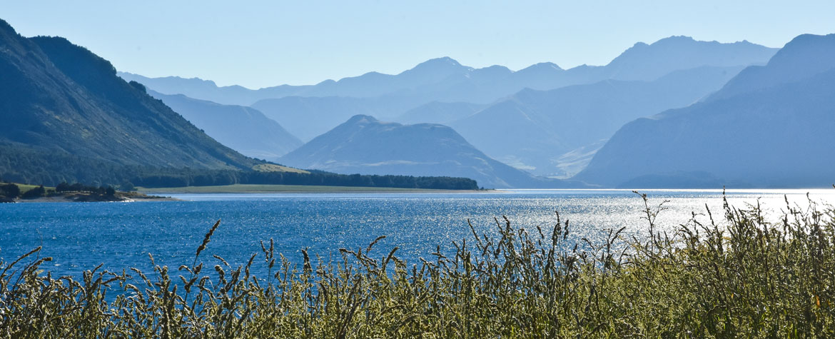
Think blue: Blue sky, blue lake and even the mountains surrounding Hāwea are pale smoky blue.
Those mountains, bare of forest, show their structure in patterns of the jagged rocky escarpments and patches of pasture. They have snow on the top, white and bright. This is high country station territory: Hunter Valley, Dingleburn, Lake Hāwea Station, each with thousands of hectares of scrappy pasture ideal for leggy, lean merino sheep.
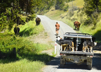
We drive up the east side of Lake Hāwea towards Dingleburn Station. The gravel road, skinny, rutted, dusty, sometimes edging around a cliff above the lake, is the perfect thing to put the Volkswagen Amarok through its paces. This powerful six-cylinder king of lifestyle utes is not ours, unfortunately. We borrowed it. Sam, my husband, loves driving it, appreciating the power that allows him to quickly and safely pass wombly tourists and I love its supremely comfortable seats and how it rides softly over dirt-road lumps and bumps.
The Timaru River joins the lake, breaking into tendrils like a frayed rope. I wander around, paddle in the icy water and wonder what it would be like to live here between lake, mountains and sky.
Under trees a camp is being set up; blokes arrive in dusty utes, dogs on the back, for what looks like a female-free night around the campfire. That is what it must be like to live here. Work done for the week, you camp out with your mates and tell yarns.
Back in Hāwea, in Sails Bar, the lake spread before us, an old codger talks to anyone who will listen. “Last New Year’s day I got up at three in the morning and walked up the Timaru River and shot two stags. Couldn’t carry them both out so, lucky, I found another hunter and gave him one. Don’t like meat to rot.”
Aha! An early morning hunting expedition is likely the reason for that gathering of men, dogs and utes.
It’s a glorious drive along the west side of Lake Hāwea, with wow views of pasture, lake and mountains following each other almost as fast as the fence posts flick by. Highway 6 swings left at The Neck, a narrow, low, isthmus between Lakes Hāwea and Wanaka. In just one kilometre we are in a different world. Mountains, yes, but they are topped with clouds. It’s cooler, there’s forest instead of farmland, manuka and kanuka in flower instead of briar roses.
Makarora township, in a valley by the river of the same name, has a pub, an airstrip, a few deer farms, a lot of forest and the Makarora Tourist Centre, where we stay in one of a dozen A-frame cottages.
No alarm clock is needed because the dawn chorus is a loud combination of tweeting, chiming and trilling. Kereru, fantails, tomtits, tui, bellbirds, and imports such as finches and thrushes, are all easy to spot on a short forest walk.
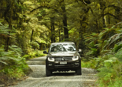
The road from Makarora, over Haast Pass and beyond to the coast, is through virgin forest.
In theory this 80km drive can be done in just over an hour but we take all day and visit every waterfall within walking distance. And there are plenty, mostly metaphorically named: Fantail Falls, Thunder Creek and Roaring Billy. Waterfalls, nature’s never-ending show of sound, action and power, have their own individual magic and a bonus is the forest walks to see them.
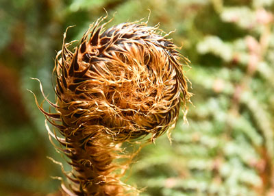
Before the Pass, it’s mostly beech forest. Trees have black mossed trunks and their branches are festooned with pale green moss. Years of leaf litter cover the forest floor, a paradise for lichens, fungus and ferns. Up close, all elements make up a beautiful and intricate world of growing things.
The path to Roaring Billy is filtered filmy green. Tall tree ferns dominate but there are ladder ferns, climbing ferns, round-leafed kidney ferns clinging to trees and tiny gauzy ferns under fallen trunks.
From Haast township to Jackson Bay the road is straight, flat and sealed. The myriad of forest greens is interspersed with bursts of vivid red rata flowers and, in places, giant trees touch overhead while luscious ferns unfurl below.
The mountains hide behind forest but at Arawhata River the bridge is a viewing platform up the wide valley, the river carved to where wisps of cloud cling to snowy peaks. The river is wide, clear and turquoise, swirling into pools and rushing over boulders, rolling them smooth.
We’re told there’s greenstone in the gravel. Fossicking for stones in the still morning sun, with the soothing river thrum, is a pleasant pastime and maybe, just maybe, Sam found a piece of greenstone slightly bigger than a match box.
Then we leave the coast and follow a gravel road inland, alongside a tributary, through podocarp forest; totara, rimu, southern rata, matai and miro. Like the beech forest, it has an understory lavishly decorated with fern, lichen and moss but the canopy is taller, more grand and open. It’s an easy stream-side walk to Lake Ellery where, in perfect stillness, the forest is reflected.
Jackson Bay, at the southern end of the West Coast Road, is sheltered from the predominant south and west winds. This safe anchorage is the reason the road reaches this far. The village consists of 12 houses, a long wharf and a fish and crayfish chiller warehouse. And, surprise, a café in a caravan. The Cray Pot, perched on the seafront, serves great kai moana ‒ blue cod, whitebait fritters, seafood chowder, crayfish and more.
Locals fish off the wharf, dolphins play in the bay, a fishing boat arrives at the beach, another one is launched and bigger commercial boats sit calmly at buoys. We eat our lunch and watch it all.
From lakes, through ancient forests and mountain passes, past waterfalls and rushing blue rivers, to the sea; this journey pays homage to our land’s extraordinary geography and wild beauty. And endearing Jackson Bay is the small exclamation mark at the end of the road.
Reported by Liz Light for our AA Directions Autumn 2018 issue