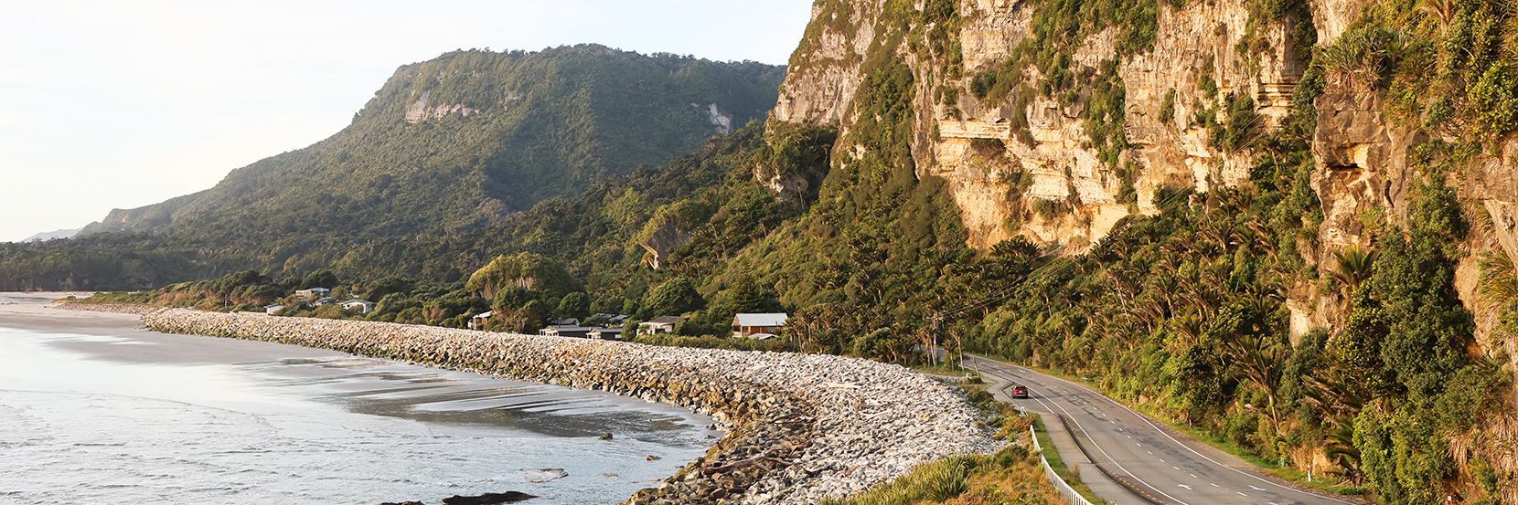
Road trip: Christchurch to the West Coast
03 March 2026
Take a looping road trip from Christchurch to discover the wild beauty of the South Island's West Coast.
Explore the remote river valleys, beech forest and mountainous landscapes of Canterbury's St James Conservation Area.
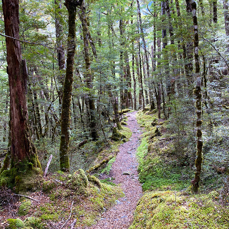
A 15-minute shuttle along the South Island’s Lewis Pass delivers me to St James Walkway for a five-day tramp. I walk beech forest between spindly trunks, thick trunks, and ones coated in vibrant moss on trails confettied with autumnal-coloured leaves. Rocky creeks and streams are crossed; I sway on suspension bridges. I cross swathes of hay-coloured tussock and avalanche areas bearing warnings not to stop between July and October. Matagouri dots the landscape, its thorns vicious looking.
In a clearing, 20-bed Cannibal Gorge Hut is dollhouse-like, dwarfed by Spenser Mountains’ scree-scarred Gloriana Peak beyond. William Travers, an 1800s station holder in the area, named the range after English-poet Edmund Spenser, the peak after a character from his 16th Century poem ‘The Faerie Queene’.
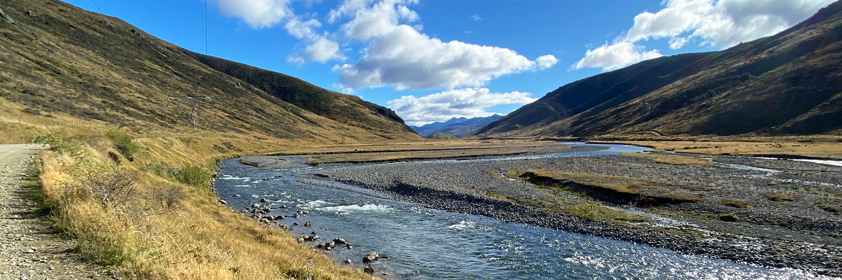
At Ada Pass Hut I bathe in shin-deep, chilly Maruia River viewing the magnificent, jutting mountains. From Christopher Hut’s deck spreads a panorama of thrusting peaks, saddles and shadowy V-shaped valleys. I am a mere speck.
On a bleak day, colours fade to pastel. Westwards, ominous black clouds provide dramatic backdrops. Elsewhere in the sky, rapidly moving clouds play hide-and-seek with walls of mountains and wispy, low cloud hangs amongst moss-draped treetops. A rainbow meets a river.
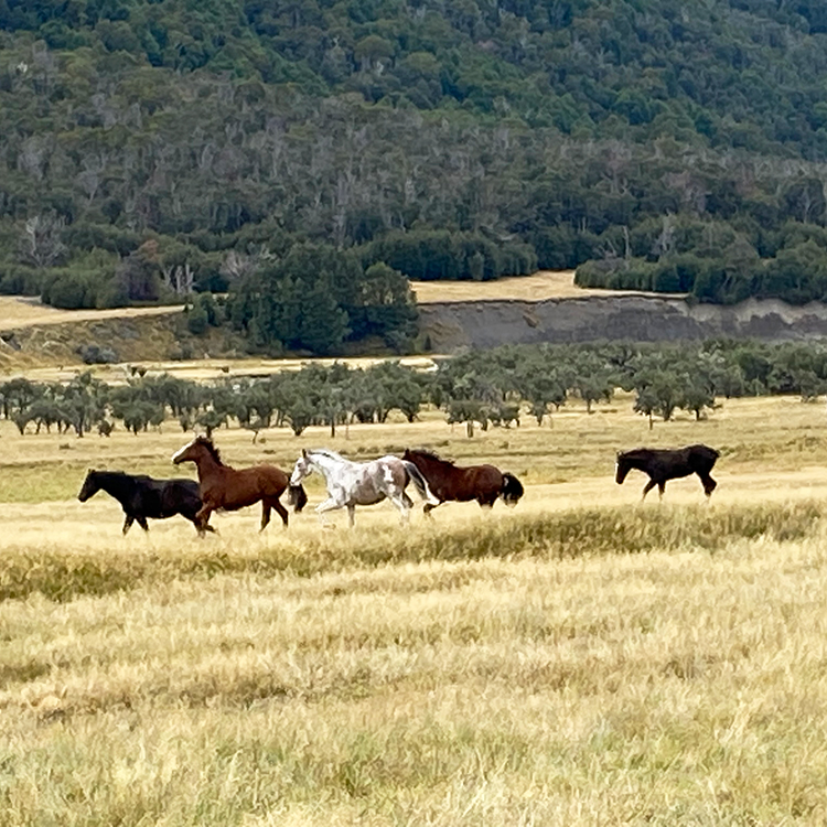
Piwakawaka fantail and kakaruia South Island robin accompany me. Sandflies plague when I stop. A kahu or hawk feeds on a dead rabbit. Black-headed Canadian geese, high-pitched airhorns, peer periscope-like amongst tall tussock galloped by wild St James’ horses. The herd, a biannual muster and sale limiting numbers to 80, is managed by descendants of the Stevenson family, St James Station owners from 1927. It was one of the country’s largest cattle and sheep stations, an amalgamation of smaller holders dating back to 1862. Government-purchased in 2008 to ‘protect its natural, physical and cultural values’, it became part of the St James Conservation Area.
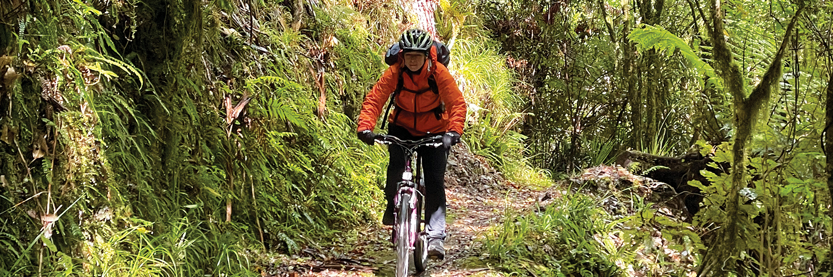
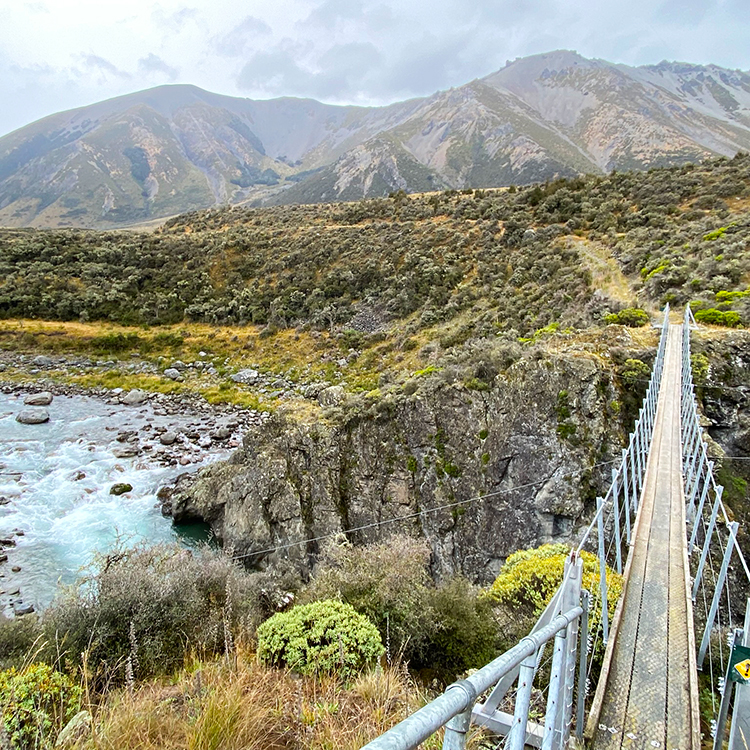
I walk between four and six hours a day, extending day three between Christopher and Anne Huts exploring some of the St James Cycleway. Crossing fast flowing, thigh-high Waiau River over slippery rocks has me questioning why I’m doing this. I nearly topple in and there is a lack of trail markers. Thanks to maps.me app I navigate across tussock and boggy ground to Saddle Spur Bridge suspended above Waiau River, turquoise in the rock gorge. It was worth the extra three hours. I finally see humans that evening: five men in Anne Hut who barely speak.
I’ve grown used to solitude and being overwhelmed by the grandeur. I don’t want it to end.
Emerging at Boyle Village Outdoor Education Centre, I drive Lewis Pass to Hanmer Springs to cycle the St James Cycleway in St James Conservation Area’s southern part. The Great Ride is a 59km loop, unable to be ridden as such with apparently no safe crossing of the Waiau River since storm-damaged McArthur Bridge’s 2021 removal.
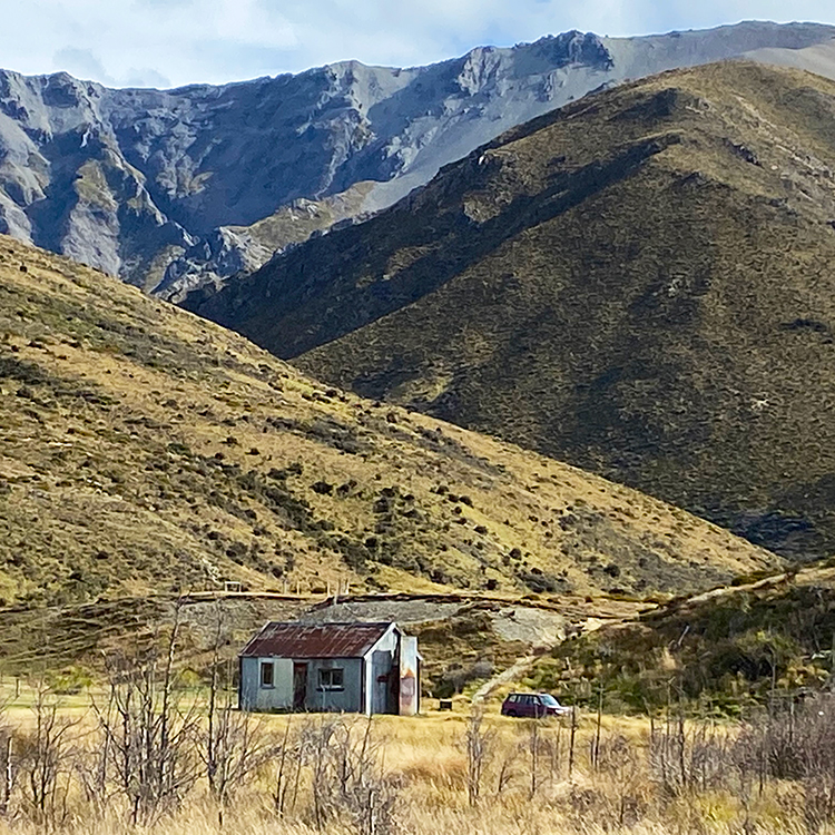
Next morning, it’s a half-hour drive up gravel, potholed Jacks Pass and on to Tophouse Road to St James Homestead. All that remains, after it burnt down in 1947, are three brick chimneys. Built around 1880, the faded red, corrugated iron woolshed, cookhouse and stable still stand. There’s not a soul around.
Under an overcast sky I bike westwards on gravel through a khaki and golden landscape hemmed by the rugged St James and Opera Ranges. Somewhere, on their other sides, I had walked.
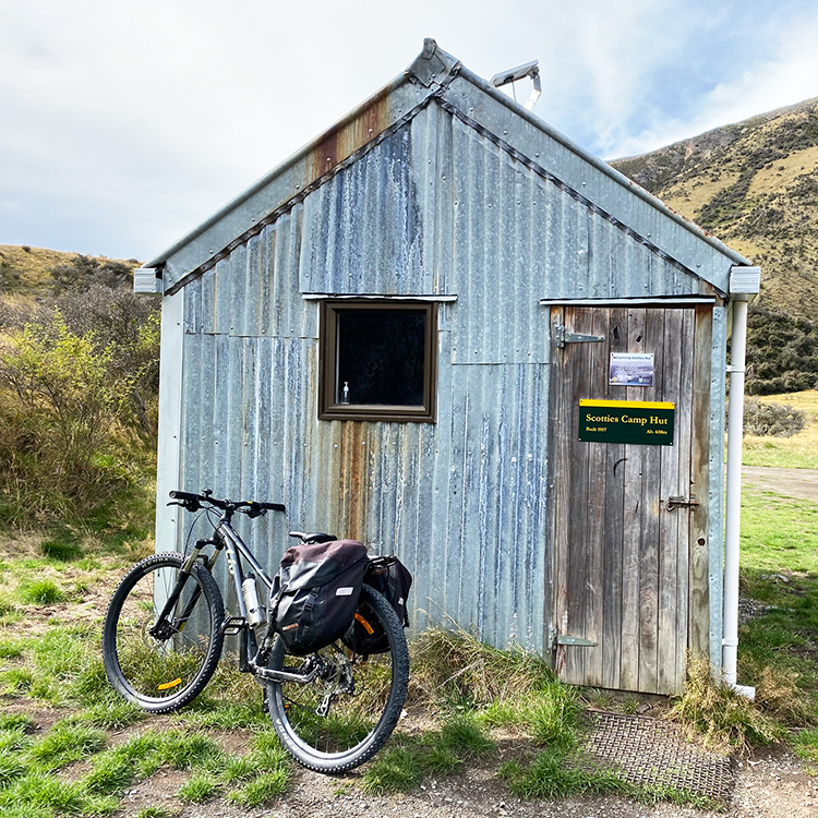
I reach Peters Pass looking over the Edwards River flowing across flat Edwards Valley, ranges thrusting beyond ranges. Seventeen kilometres in, above the river, is four-bunk Scotties Hut, built in 1957 for mustering. Heart pounding, I ascend 754m Charlies Saddle, sliding backwards, hauling my bike metre by metre, stopping often. From the top, ranges are a buff sea and the powder-blue Waiau River disappears between mountains.
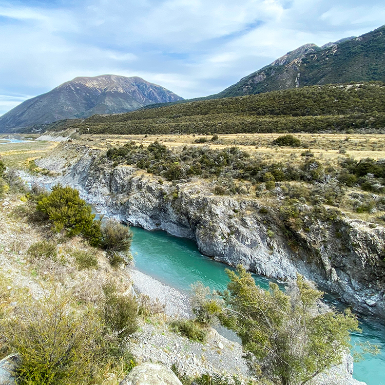
Rocky descents and matagouri-dotted, tussock flatness lead towards distant snow-splashed ranges. I reach where McArthur Bridge once stood, concrete foundations on the gorge’s opposite side all that remain. Far below, turquoise water rushes through the ravine. Stunning.
Mind and body battle on the return. I detour 1.3km off the trail, 30-minutes from Scotties Hut, to Cow Stream Hot Pools. Whiffs of sulphur greet me before I spot a rock pool of indigo water above the stream. Three more are streamside along a bush track. Immersing my feet, I last mere minutes. The sandflies are unbearable.
Hares bound across the track nearing St James Homestead where, above the track head, a sign states: A Great Ride in the Big Country. That 50-ish kilometres sure was.
Next day, I’m back to cycle the trail northwards, along Tophouse Road, St James Conservation Area’s eastern boundary. With corrugated gravel almost the entire way to Maling Pass Carpark, it runs parallel to the Clarence River which tumbles white over rocks, splitting into quieter, azure braids, then merging again. A gradual ascent and a headwind whistling through pylons alongside has me head down, struggling in low gear.
Corrugated iron two-roomed Fowler Hut sits at Mount Seymour’s base where the Fowler Pass Track traverses the St James Range giving access to St James Walkway. I peer in its two bare rooms then battle on; a few 4x4s and motorbikes pass.
Tophouse Road enters Molesworth Station. Several kilometres on, I cycle a 1.5km dirt road to Lake Tennyson, named after poet, Lord Tennyson, fringing Nelson Lakes National Park’s eastern edge. Atop an ascent, beyond rolling bronze tussock, I spot it tucked in a valley, its misty far end hemmed by Spenser Mountains’ slopes.
It’s easy cycling homestead-bound, wind pushing me past windblown tussock, wild cerise roses, and golden poplars on the Clarence’s riverside, backdropped by soaring, brownish ranges.
Outstanding.
This story is from the Summer 2025 issue of AA Directions magazine.