
WIN! A pair of Teva Hydratrek sandals
12 December 2025
AA Directions has three pairs of Teva Hydratrek sandals to give away.
Take a day trip into Auckland's Waitākere Ranges to experience these three great short walks.
Piha, on Auckland’s west coast, is a dramatic, energising stretch of beach. I go there in all seasons for a blast of fresh air, a bracing swim in the frothy surf and dog walks at sunset. Above the beach, thickly forested hills loom, mysterious and seemingly impenetrable. Within the contours of the hills are dark, shadowed valleys, including the one that Kitekite Falls tumbles down.
At the bottom of the big hill that leads down to Piha, turn up Glenesk Rd and drive to the carpark at the end. It’s well signposted. There are toilets, picnic tables and giant eels that reside in the stream directly below the small bridge at the carpark; they’re easy to spot.
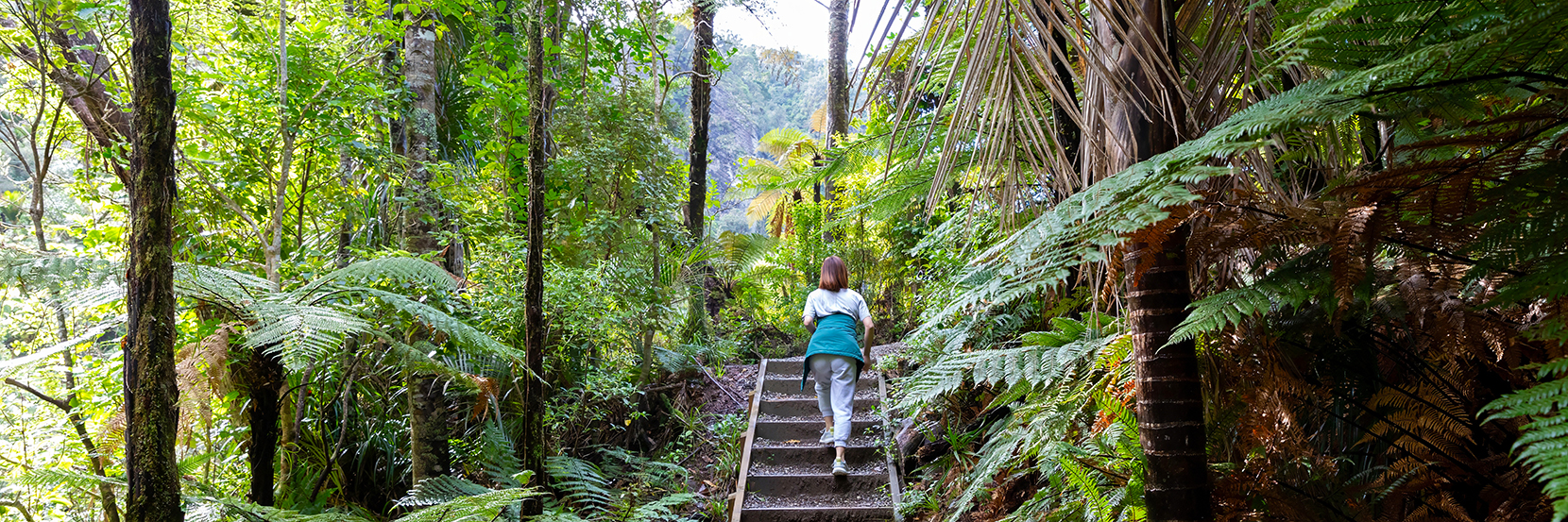
The Kitekite Falls track starts, like all tracks in the Waitākere Ranges, with a boot cleaning station. We obligingly scrub the soles of our Teva sandals, jump on the little platform that squirts disinfectant up our calves, and off we go – knowing we’ve done what we can to avoid the spread of Kauri dieback disease.
It’s a well-made gravel track interspersed with boardwalks to the base of the falls. Three tiers cascade from 40 metres in a pretty tumble. Around it, lush plant life thrives, and the surrounding forest is healthy and full of variation.
From there, sturdy steps climb to the top of the falls. A steady plod, with occasional pauses, carries us up to a clearing and a deep, sunlit pool fed by a stream threading through rocks. We rock-hop across the stream to rest in the shade with a picnic lunch. Next time, I will bring togs.
Once through Titirangi, take Huia Rd at the roundabout and follow the edge of the Manukau Harbour with the southern end of the Waitākere Ranges rising theatrically above the road. At the far end of the small settlement of Huia is a narrow bridge; a few corners after this is the carpark for Karamatura camping ground.
There are options for several longer walks, but we opt for the Karamatura Loop track which, if you walked without stopping, takes about 45 minutes. We took it clockwise, which was the steepest way, with lots of steps up the well-formed track, so we were very happy to arrive at a pool at the base of one of the waterfall’s tiers, although there were several other swimming holes, too.
The top pool, the one we encountered first, was deep and clear, surrounded by ferns dripping with droplets from the falls. It was quite a scramble down to get in the pool and equally challenging to climb out again – but my waterproof Teva sandals with their grippy soles helped.
Further down the track, other pools were easier to access. We took our dog who had to stay on lead but enjoyed himself regardless. The track is historic, too, including a stretch along a timber tramway.
On the way back we headed to the famously good Huia store for coffee and pies. Next time I will visit the nearby Huia Settlers Museum.
Only a few minutes’ drive west along Piha Rd – on the left and a wee bit hard to spot – is the almost-full carpark for the Upper Nihotupu Dam walk. Clearly it’s a popular track.
Through the boot cleaning station, a pretty path dappled with shade leads us over a bubbling stream and across a forested plateau. Peering into the bush either side of the path, we see small pockets of water, signalling the catchment quality of this part of the ranges.
After ten minutes’ walk, we come to a loose-gravel service road which takes us down past tumbles of chattering waterfalls, over a sturdy bridge, to open views of the catchment lake. Perfectly still, it reflects clouds and the ring of green around it; birds dart for dragonflies hovering just above its skin.
Half an hour later we’re walking over the dam, looking down its massive concrete face, marvelling at the 100+ year engineering project.
We’ve brought a thermos and sandwiches so we keep walking another ten minutes or so to a picnic area. Unfortunately, there’s no swimming here as the catchment is for Auckland’s drinking water, but it’s just 14km on to Piha for a salty swim.
The Arataki Visitor Centre at 300 Scenic Drive, Ōratia is an information and education centre with stunning views over the forest. The team here can advise on other walking tracks in the ranges. Some are closed to help prevent Kauri Dieback Disease and the popular Fairy Falls track is currently closed due to fire damage.
This story is from the Summer 2025 issue of AA Directions magazine.