Up the creek: Upper Hutt
24 February 2026
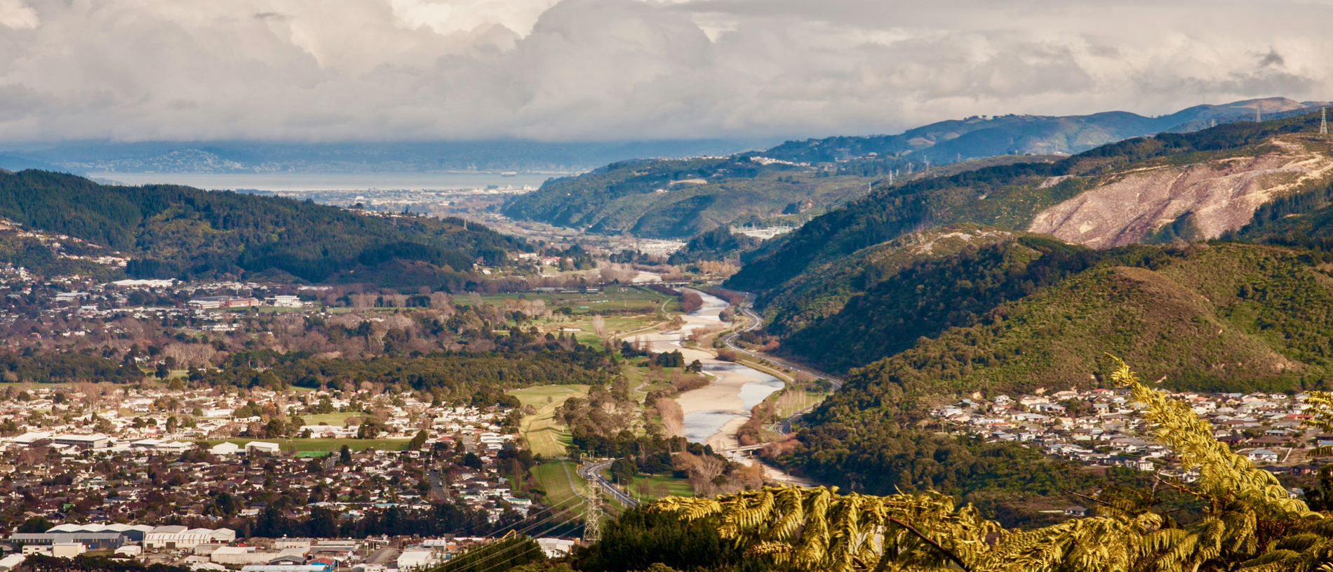
The main feature of the district, of course, is the river. Not only does it look good, but the quality of the water is excellent, too.
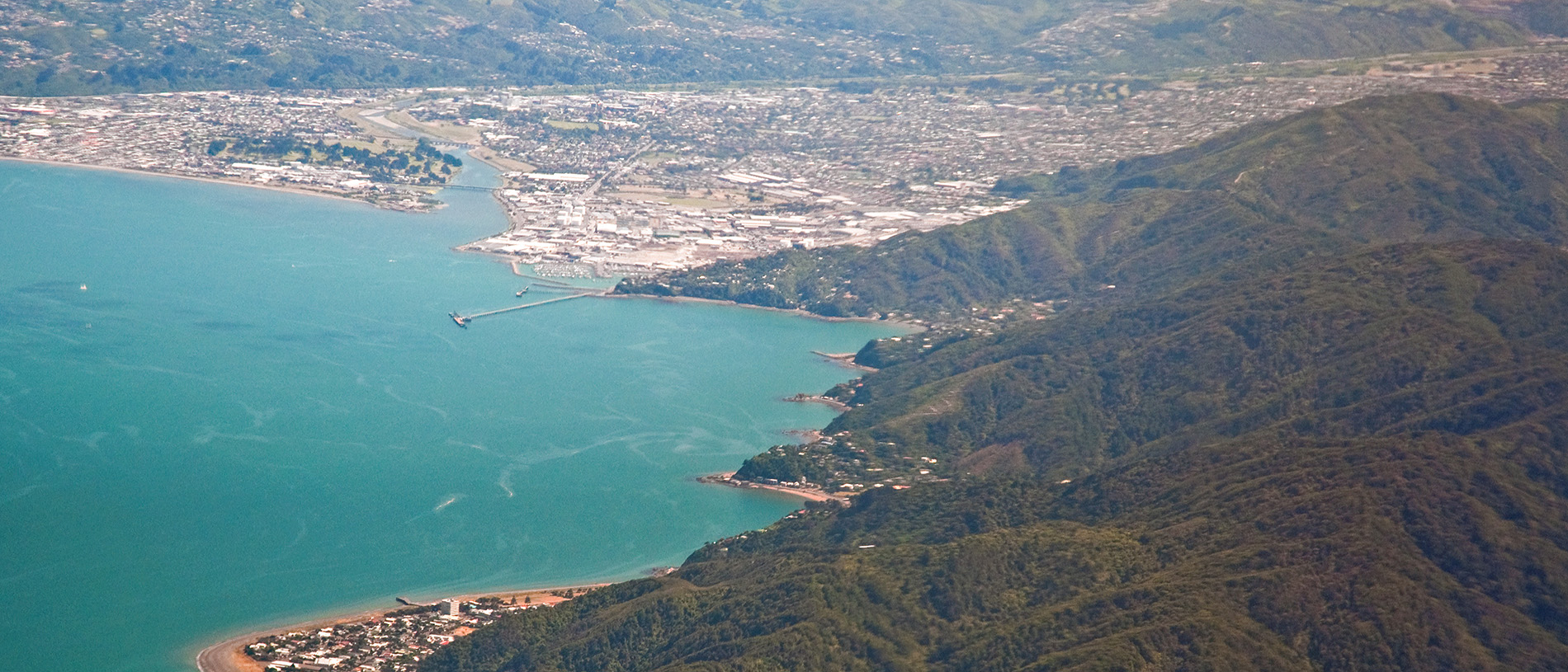
Lower Hutt: a river runs through it, called – as you’d expect – the Hutt River, although it was known by Tangata Whenua as Te Awakairangi, 'the river where food falls from the sky.' Bet there’s a story behind that name.
In fact, while most of Lower Hutt occupies the lower floodplain of the Hutt Valley, the city actually encompasses the neighbouring valley, Wainuiomata, too (the origins of the Māori name, which literally translates to ‘Great Water of Mata’, are unclear, but locals make it all academic by shortening it to ‘Wainui.’)
In all, Lower Hutt is New Zealand’s seventh most populous city. It extends from the slopes of the hills on either side of the valley north from the beach at Petone to the Taita Gorge, where Lower Hutt becomes Upper Hutt, and around the eastern headland of Wellington Harbour to Pencarrow Head.
Before the arrival of Europeans, the Hutt Valley was a swampy, heavily wooded valley, abundant in birdlife and therefore of some significance to Māori. And it’s perhaps because there was so much to go around that when the first settler ship, the Aurora, dropped anchor off Petone Beach on January 22, 1840, Te Puni and Te Wharepōuri – the chiefs of Te Ati Awa, the iwi that had mana whenua over the area – welcomed them with open arms.
This was fortunate, as the whole shipload of settlers had bought blocks of the future Lower Hutt off the plans, even though the New Zealand Company’s principal agent, Colonel William Wakefield, who had preceded them by only a few months, was still in process of figuring out whether it was even for sale.
Within five years of the arrival of the Aurora and the other ships of the New Zealand company’s first fleet, a complicated political situation had arisen, with some Māori interests aligned with the pākehā against other Māori interests (largely from outside the district, but often from within the same iwi) who wanted to drive the newcomers back into the sea whence they came. It didn’t help that the New Zealand company had been a little bit cavalier with regard to who had bought what from whom and for how much.
With tensions escalating, the government established a couple of fortified positions in the district, and inevitably as it seems, one of these became the site of an early encounter in the wider conflict that became known as the New Zealand Wars. Today, there is a memorial to the fallen on the corner of High Street and Military Road just north of the Lower Hutt CBD.
With a road established between Wellington and the Hutt Valley (it was sealed in 1924) and a bridge built over the Hutt River (several goes were required before any of the bridges could be regarded as permanent), the population of the district began to grow.
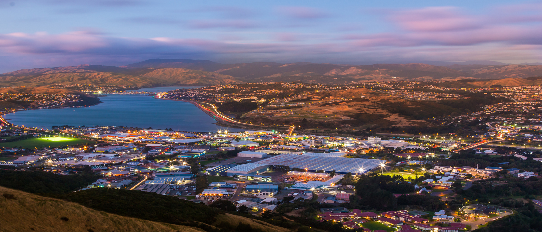
As did industries. The twentieth century saw Lower Hutt (especially Petone and the eastern suburb, Gracefield) become the lower North Island’s principal industrial area. When bulk motor fuel replaced four-gallon tins in the 1920s, a ‘tank farm’ for petrochemicals was established at Seaview, across the river mouth from Petone Beach. And when local motor vehicle assembly began, both General Motors and Ford chose Lower Hutt as sites for their factories, owing to the presence of the broad tracts of flat land that their huge assembly plants required. Other industries – woollen mills and plants for processing tobacco, soap and toothpaste, to name a few – soon followed.
Whole new suburbs were constructed to accommodate the workers. The first state housing in the country was built in Patrick Street, Petone in 1906, and a whole planned suburb was built at Naenae (the name means ‘sandfly’) in the 1950s and 1960s.
Beyond Gracefield, a road winds around the attractive eastern bays to Days Bay and Eastbourne, which were popular day-tripping destinations for Wellingtonians from the outset. A regular ferry service was inaugurated in 1906 using a vessel that some old-time residents still remember fondly, the SS Cobar. Backed by steep, rocky cliffs, building sites in this reach of Lower Hutt are at a premium and hence some of Wellington’s most exclusive housing is here. It was also on the steep, pebble beach at Eastbourne that many of the passengers of the ill-fated Cook Strait ferry, the TEV Wahine, washed up after the vessel foundered in a ferocious storm in 1968.
Wainuiomata was slow to be settled, as it was densely forested. And once it was cleared, access was difficult. A tunnel was mooted – started and nearly completed – but never commissioned, instead being used for utilities. Being surrounded by high ranges – Wainui Hill to the west, the Orongorongos to the east, Wainui is a place apart from the rest of Lower Hutt. On bad days, it is considerably colder and danker. On good days, it can be two or three degrees warmer.
As you’d expect, Petone makes much of its long history of European settlement. The names of the first ships – the Tory, the Aurora, the Oriental, the Adelaide and the Cuba – are all commemorated in street names, and there is a well-curated exhibition of the early days of the European presence at the Petone Settlers Museum on the foreshore. The museum occupies the Wellington Provincial Memorial Building, which was opened in 1940 to commemorate the centennial of European settlement in the region. It was recently fully refurbished. Nearby on the foreshore, a Celtic cross commemorates the first church service conducted on land in the Wellington region, preached on that very spot by the Reverend John Macfarlane on 26 February 1840.
The other significant cultural site in Lower Hutt is the Dowse Art Gallery at the southern end of the city CBD. In the 1960s, it had originally been intended to extend the Lower Hutt War Memorial library to include gallery space, a project championed by Mary Dowse, the wife of the long-serving mayor, Percy. But when Mary was killed in a car accident in 1964, it was decided to build a whole new gallery in her honour. The Dowse Gallery was opened in 1971, sadly a year too late for Percy. After being extensively remodelled, it was re-opened as the New Dowse Gallery in 2013. It hosts a wide variety of exhibitions but has a particular reputation for contemporary art.
Among the more significant buildings in Lower Hutt is Vogel House in Woburn Road, a grand old settler’s mansion gifted to the state to serve as the Prime Minister’s residence.
As with most of Wellington, Lower Hutt’s proximity to the splendours of nature makes it perfect for a wide range of outdoor activities. The beach at Petone is a very popular place for jogging, walking and dog-walking, and the pier at the western end is used for fishing.
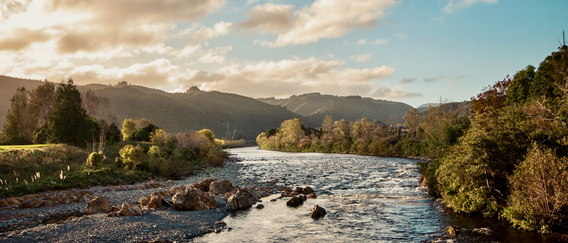
The banks of the Hutt River have been developed for both walking and cycling. The carpark for the Hutt River walkway is the scene of a regular Saturday morning market. The Petone Rowing Club at the western extremity of Petone Beach and the yacht club next to the Settlers Museum are the breeding ground of champion rowers and centreboard sailors alike.
Wainuiomata is adjacent to Catchpool Valley, part of the Remutaka Forest Park. There are tramping tracks and huts in here next to the Orongorongo River which many Wellingtonians and Hutt City residents remember fondly as their first tramping experience. The hunting (for deer and pigs) is pretty good in here; there are heaps of goats out beyond Eastbourne toward Pencarrow Head. The gravel track around the foreshore to Pencarrow Light – the first permanent lighthouse in New Zealand – is an easy and attractive day-walk or cycle.
The fire-brakes in the pine plantations on Wainui Hill are a mecca for mountain bikers, as are the many trails in Belmont Regional Park on the western side of the valley.
There is a good range of suburban restaurants throughout the Hutt Valley, but the gastronomic centre of it all is Jackson Street, which has a wide variety of cafés and restaurants. Perhaps the pick of these are the very hip Queen of Jackson (a craft beer bar with attached bistro) and La Bella Italia just off Jackson in Nevis Street, an Italian café and delicatessen established by celebrity foodie Antonio Cacace. For a different dining experience, fish and chips from John’s Fish Shop on Petone’s Esplanade eaten across the road on the beach is a lovely way to spend a summer’s evening.