Loved by the locals: Far North
24 February 2026
Catch a wave at Ahipara, discover whaling history, find an idyllic campsite, take a dip and try the famous fish and chips in the Far North.
North of the Bay of Islands, things get a little wilder.
There’s more bush and scrub, farmland is less kempt and the towns fewer and further between. This is Muriwhenua, the tail of Māui’s legendary fish, the northernmost tip of the country.
The Māori name for this part of New Zealand literally means ‘the end of the land’. Populated for centuries, this sub-tropical region with its shallow harbours and empty white-sand beaches holds great spiritual significance for Māori, with northerly Cape Rēinga believed to be the jumping off place of the souls of the dead before they depart for the homeland Hawaiki. Here at the sharp end of the country two bodies of water also meet at the Columbia Bank, with the waters of the Tasman Sea and the Pacific Ocean mingling in a maelstrom of tides.
Sometimes called ‘the winterless north’, for its mild climate, it used to be known as ‘the roadless north’, famed for its paucity of decent roads.
In 1917 local politician Allen Bell led a tour to show Members of Parliament and journalists the state of the region’s roads: clouds of dust, alternating with axle-deep mud, meant not all of them stayed the course. Today accessibility it’s still a political hot potato, with the number of one-way bridges on the major roads becoming a by-election-deciding issue in 2015.
The kauri trees that once covered this area are long gone, but their gold remains – the golden amber of kauri gum, hard-won from the swamps of the Far North in the late 1800s and early 1900s by armies of mainly Dalmatian (Croatian) and Māori diggers. This hard, fossilised resin, exported to make varnish and linoleum before chemical compounds, was the backbone of the area’s economy for years; in the 1890s the industry provided employment for around 20,000 people. Today what lies beneath the soggy soil is even more valuable: swamp kauri, huge logs up to 50,000 years old, preserved in peat and sought after for making furniture.
The main road runs inland north of the Bay of Islands, but it’s worth taking the byways to find empty white-sand beaches and bach settlements like Mātauri Bay, looking out to the Cavalli Islands where the Greenpeace ship Rainbow Warrior lies, now an attraction to scuba divers; sheltered Te Ngāere with its golden sand; and Tauranga and Taupō bays, on either side of the hilly Whangaroa Harbour.
Another short detour leads to the seaside town of Mangōnui, with its historic pub and store built out over the water. Looming over the entrance to the pretty harbour is the terraced Rangikāpiti Pā, once a stronghold of Ngāti Kahu Māori and commanding wide views of Doubtless Bay, beyond the beachside settlements of Coopers Beach, Cable Bay and Taipa.
On the northern side of the curve of this large bay is the Karikari Peninsula, its western side defined by the Rangaunu Harbour, the name meaning ‘to pull in a shoal of fish’. There are other shallow harbours further north on the Aupōuri Peninsula – Houhora, Pārengarenga – as the land narrows towards the tip. Wading birds abound, including the migratory godwit, which summers here before heading north on its annual epic migration to Siberia and Alaska via China.
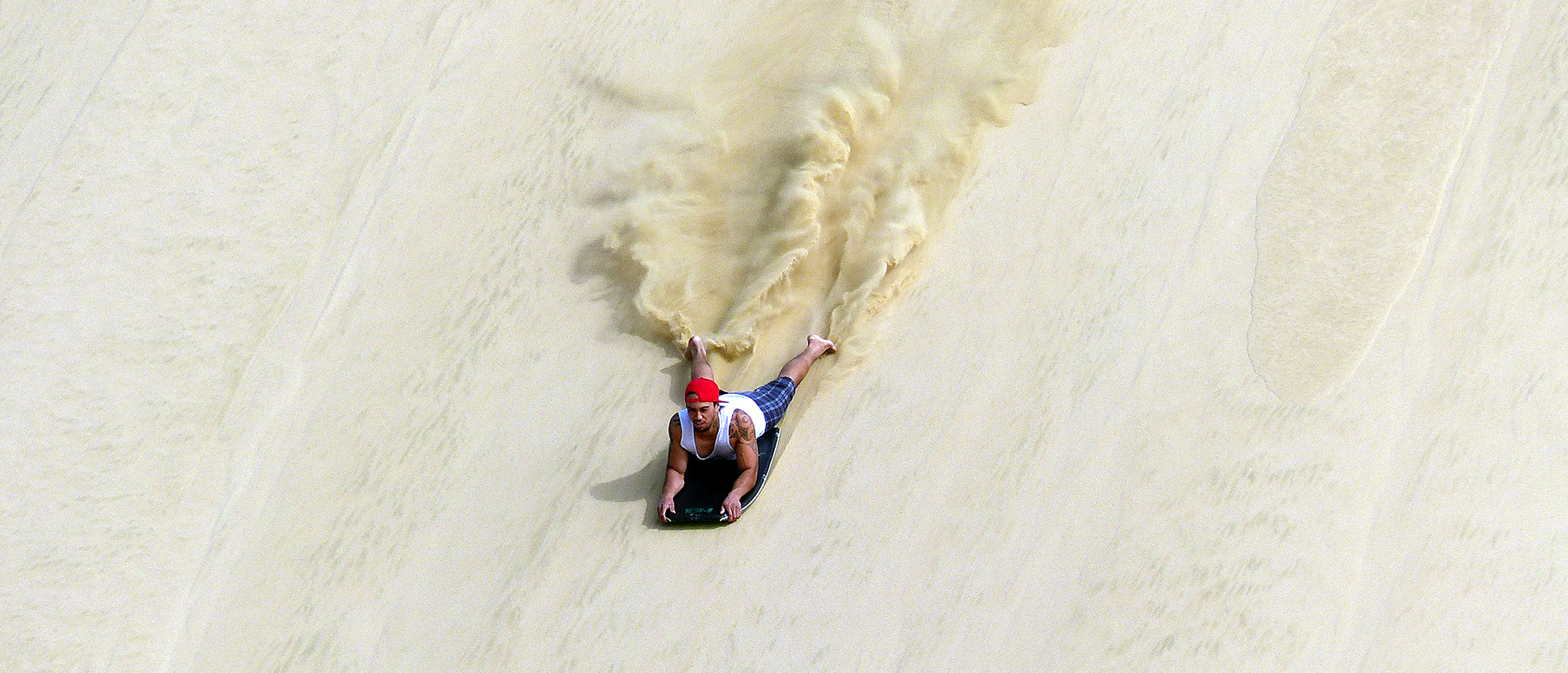
Running up the western side of the Aupōuri Peninsula to the northern cape is a beach which is also a road. Te Oneroa-o-Tōhē – the long beach of Tōhē, a Māori ancestor – is usually known by its more prosaic and also inaccurate name of Ninety Mile Beach. In fact, it’s more like 60 miles (96km long), stretching from Ahipara in the south to Cape Maria van Diemen in the north.
Unlike west coast beaches to the south, the sand here is white, not black, and is backed by dramatic dunes.
It is used daily by tourist coaches and locals, searching for the best surfcasting spots to catch big snapper and is a legal road with a 100km/h speed limit.
One of the first Europeans to traverse the beach was also the first to use a land yacht in this country, of a sort: missionary William Puckey rigged up a sail to his dray and let the persistent wind blowing along the beach help out his horse as he travelled to the Far North to spread the word of god.
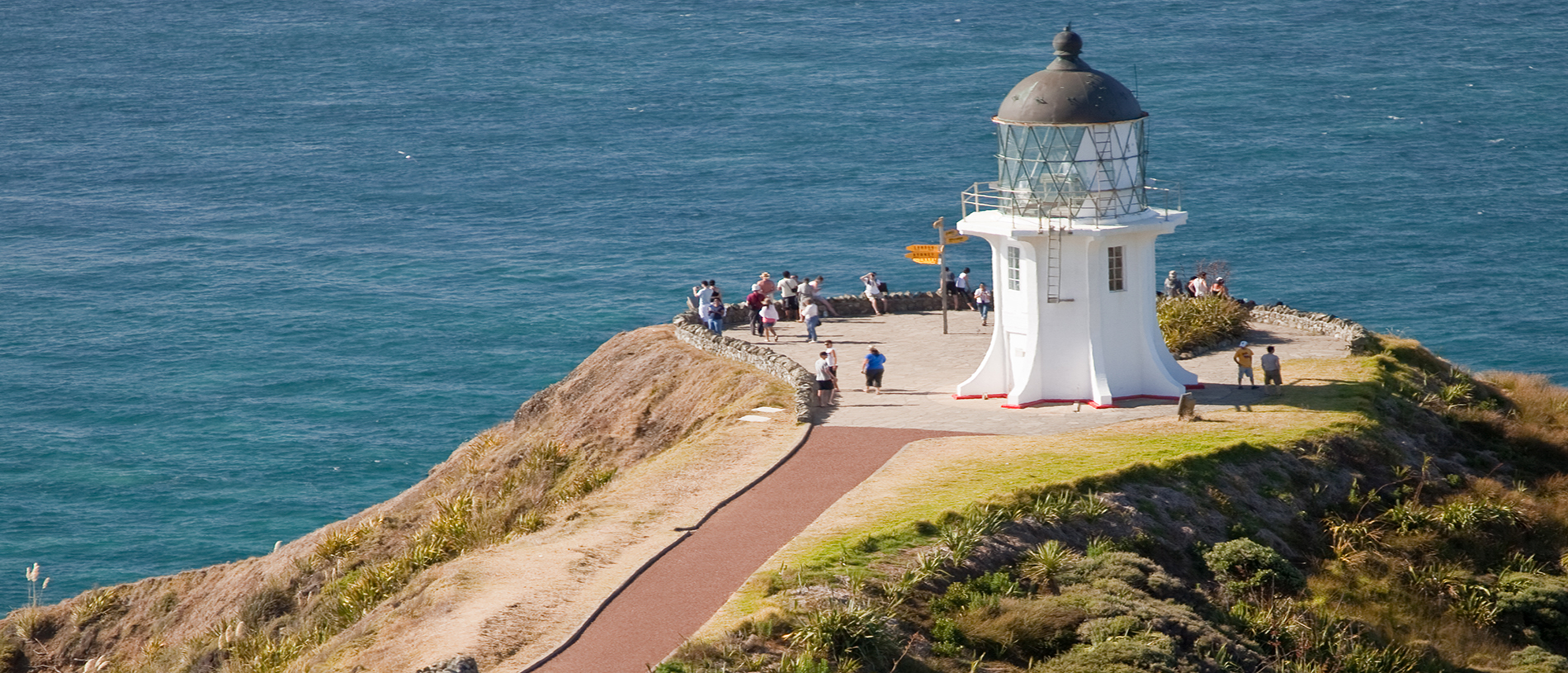
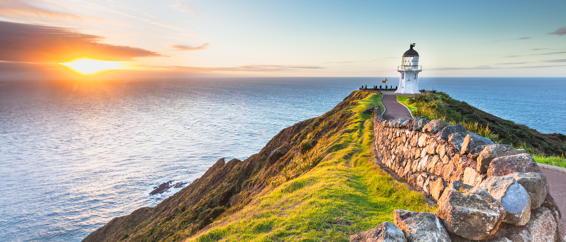
The road to Cape Rēinga has been sealed only since 2010, but that doesn’t stop thousands of tourists from making the pilgrimage each year to take photographs by the solar-powered lighthouse – one of the most powerful in New Zealand – and the multi-directional sign.
The cape might be crowded with daytrippers, but greater peace and a sense of spirituality – along with basic facilities – can be found at the isolated DoC campsites in the Te Paki Recreation Reserve, such as at Tāpotupotu and Kapowairua (Spirits Bay). There are great walks here, too, along this dramatic coastline.
And just so you know, Cape Rēinga is not actually the northernmost point of the island, however; this honour goes to the Surville Cliffs at North Cape, some 30km to the east.
These are named for French explorer Jean François Marie de Surville, whose ships virtually passed in the night with those of Captain James Cook, on his first voyage to New Zealand in 1769.