The Tongariro Alpine Crossing is like walking on another planet. © Great2Travel

Tongariro Alpine Crossing


View the map

TAP FOR MORE INFO:

It's well worth the sweat...

Whereas many people’s experience of the wonders of Tongariro National Park are limited to vistas of the volcanic peaks from the Desert Road or to a visit to the Mount Ruapehu skifields, the Tongariro Alpine Crossing offers an insight into just why the National Park is rated an international treasure and listed as a UNESCO World Heritage Site.

The crossing takes seven or eight hours to complete at a steady pace and in favourable conditions. Keep in mind that you'll be in an alpine environment. The conditions can change rapidly no matter the season, so be prepared and wear appropriate clothing. The total distance is 19.4km one-way, but the hike requires a moderate level of fitness – there are two points where the going can get pretty tough – but the reward is a day spent in some of the most extraordinary landscape dear old Aotearoa has to offer. 

Most trampers tackle it from the western end, following the Mangatepopo Stream up to the foot of a steep saddle between Tongariro and Ngāuruhoe.


You’ll be puffing a bit by the time you reach the top of the Mangatepopo Saddle, but reaching the crest is like stepping onto the surface of another planet.

The great, even-sided cinder cone of Ngāuruhoe presides over an otherworldly scene of volcanic desolation – the ashen expanse of Tongariro’s South Crater.

The route crosses to the far wall of South Crater and there’s another brisk climb to the highest point on the Crossing. On a clear day, the views are breathtaking – over Lake Rotoaira to Lake Taupō or, in the other direction, across the North Island’s rugged heartland to Mount Taranaki, over 200km away.

The track now descends alongside Tongariro’s Red Crater, with its mineral-stained walls and active fumaroles, and past the cluster of tarns known as the Emerald Lakes for their vivid, mineral-stained green water.

The track crosses Central Crater and passes Blue Lake before winding down a steep-walled valley. This opens out to a spectacular view of the volcanic hinterland, and the track meanders down the tussock slope to Ketetahi Hut.


For a time, the descent from the hut follows the course of Ketetahi Stream, which is fed from a thermal spring higher up the mountainside. Beneath the snow-line, the final section of the track passes through beech forest in which native birds abound.

Most local accommodation providers offer transport to and from the Mangatepopo and Ketetahi ends of the track, and guides are available who can enhance the crossing experience by explaining the cultural, historical and natural significance of the landscape.

Explore more...

More stories like this

Find out more

Activities

Ride from the mountains to the sea

Beginning on the slopes of Mount Ruapehu and winding for 231km to the wild west coast at Whanganui, the Mountains to Sea Cycle trail is one of the North Island’s most dramatic rides.  Read the story . . . 

Find out more

Get outdoors

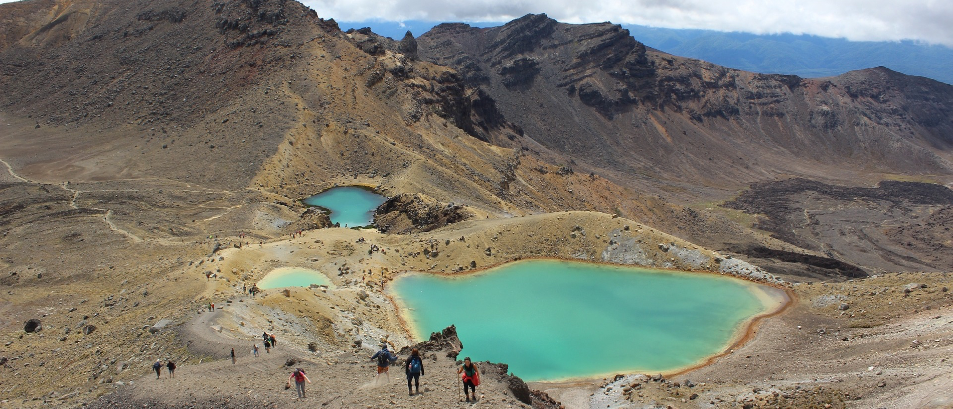
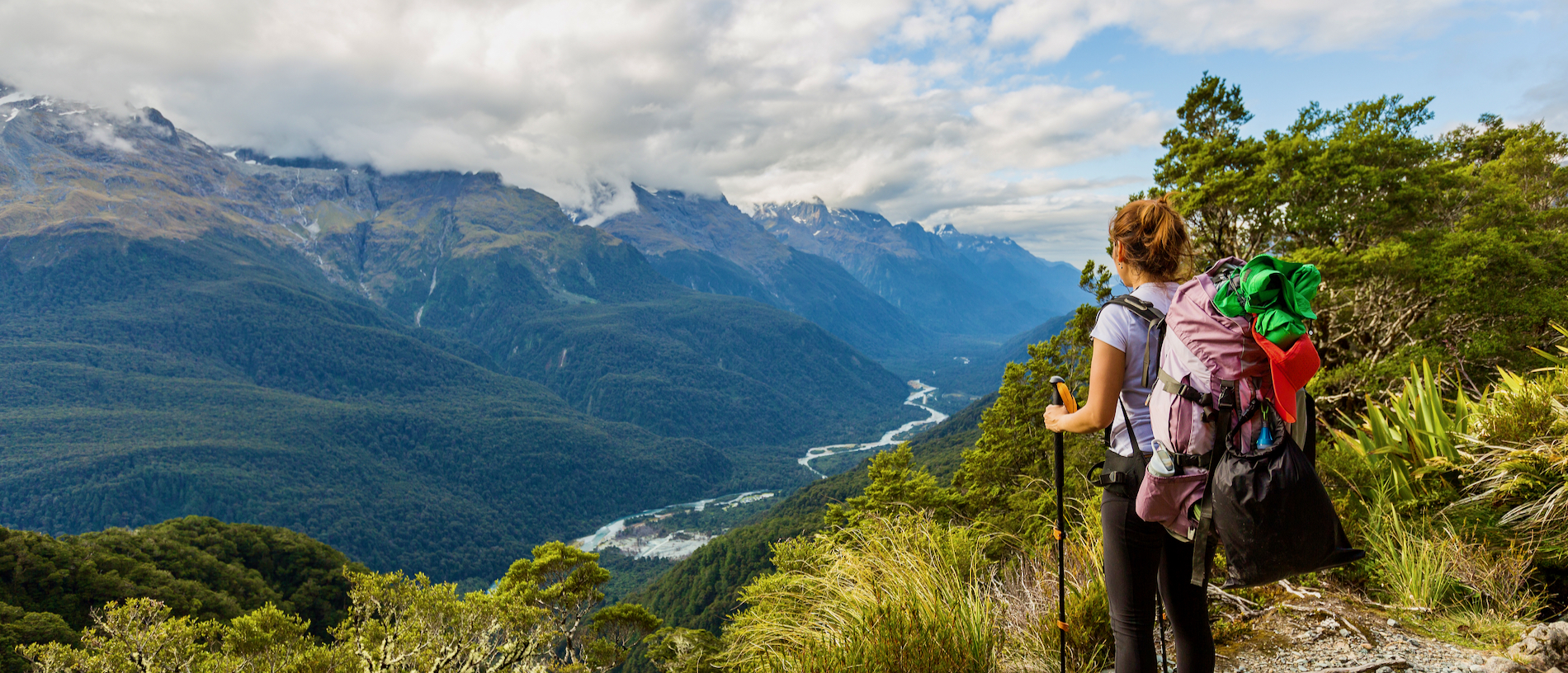
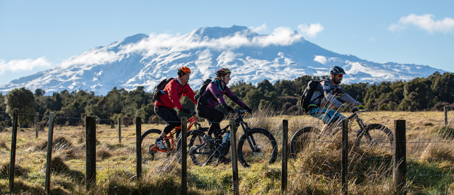
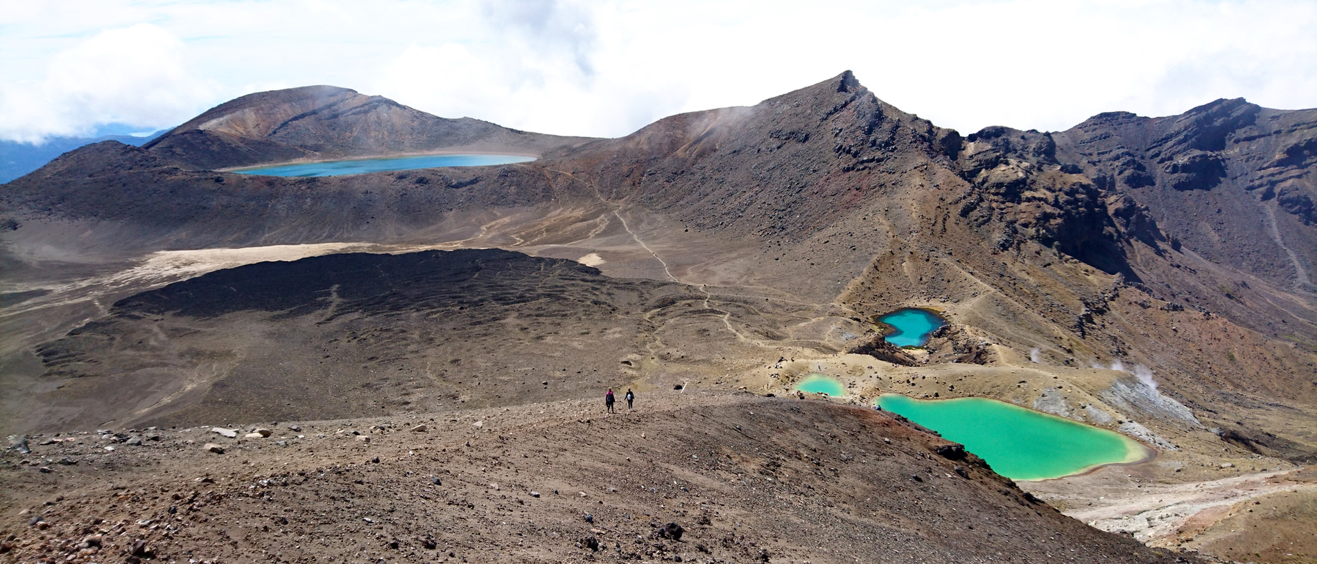
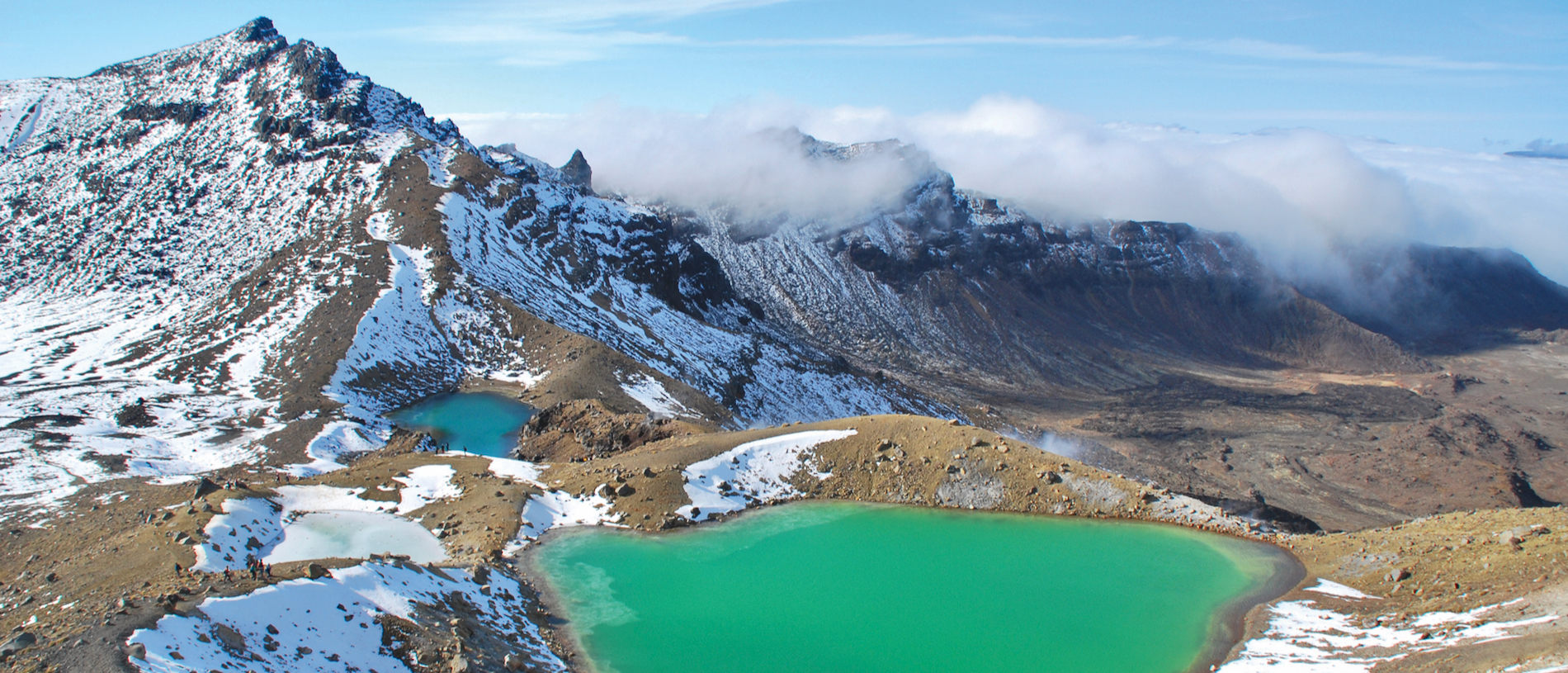
Tongariro National Park: volcanoes of the south wind

Tongariro is New Zealand’s oldest national park with excellent skiing on Mount Ruapehu in the winter season and some of the most epic mountain-hiking trails in the world. Read the story . . . 

Find out more

Get outdoors

Adventure time: tramping in New Zealand

Known in other countries as hiking, bushwalking or trekking, tramping is a uniquely Kiwi term that fits the style of walking here – often rough, frequently wet, but regularly inspiring.  Read the story . . . 

Find out more

Get outdoors

Tongariro Northern Circuit: alpine heartland

The Tongariro Northern Circuit explores a landscape of stark glacial contrasts and alpine views, with craters, explosion pits and lava flows aplenty. Read the story . . . 

AA Members save on selected accommodation with
AA Traveller

AA Members
Book now
Non Members
Book now