Six spectacular short walks for spring
Get back in touch with nature this Spring. From coastal walkways to native forest trails; hidden waterfalls to ancient volcanoes, New Zealand is packed with short walks suitable for all levels of fitness.
1. Rangitoto Summit Track, Auckland
Arguably one of the most iconic walks in Auckland, summiting Rangitoto, the city’s youngest and most distinctive volcano is a Must-Do.
An easy climb on well-formed paths amongst the lava fields takes you through pōhutukawa forest to a peak 259m above sea level. At the summit, you’ll be rewarded with panoramic views of Auckland and the Hauraki Gulf.
After Rangitoto was declared pest-free in 2011, many native and seabirds have returned to the island, so birdsong will provide the aural backdrop to your walk.
If you’re feeling energetic, bring a torch to explore the lava caves and tunnels; the Lava Caves Track is just a 30-minute return trip off the Rangitoto Summit Track.
Moderate fitness is required for the gradual and steady incline to the top of the island. You’ll also need good footwear to explore the lava fields, which can be sharp and uneven.
Track Overview:
- 2hr / 7km return, via the same track
- No dogs allowed
Getting there:
Your walk begins at the Rangitoto Wharf, a 25-minute ferry ride from Queens Wharf in Auckland City. Remember to allow time to get back to the wharf for your return ferry.
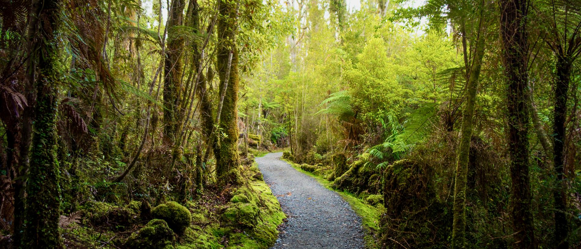
2. Lake Matheson/Te Ara Kairaumati Walk, West Coast
Lake Matheson is one of the most picturesque spots on the West Coast. Take a gentle walk through native bush to find its shimmering shores, with Aoraki Mt Cook and Mt Tasman brilliantly reflected in the dark water. The mirror-like properties of the lake are caused by organic matter leaching from the forest floor and causing the water to turn dark brown.
After crossing the Clearwater suspension bridge, the walk to Jetty Viewpoint takes you past magnificent kahikatea and rīmu, before the equally magnificent mountain view reflected in the lake. From Jetty Viewpoint, continue further around the lake and you will for more vantage points at the top end of the lake, and again at the aptly named Reflection Island.
All abilities and fitness can enjoy walking this undulating track, with the first section of the walk, to Jetty Viewpoint, suitable for assisted wheelchairs.
Track Overview:
- 40min / 1km return, car park to jetty
- 1hr 30min / 2.6km return, lake circuit
- No dogs allowed
From Fox Glacier township, travel 5km along Cook Flat Road, then turn right onto the side-road to Lake Matheson.
3. Devils Punchbowl Walking Track, Canterbury
Experience the full force of fresh mountain water falling 131m down one of the country’s most stunning waterfalls – Devils Punchbowl.
After crossing two footbridges – over Bealey River and Devils Punchbowl Creek – you’ll wander through lush beech forest before climbing 150m up a series of steps to a viewing platform at the base of the waterfall.
Devils Punchbowl Track is also suitable for a twilight walk, when you’ll have a good chance of hearing, or even seeing one of the endangered great spotted kiwi/roroa. Keep your ears pricked for a loud snuffling or a harsh whistling cry. A head-torch with an infrared light is recommended for evening walks -but definitely avoid flash photography.
As the track has a gradual incline with steps, low-to-moderate fitness is required and some people may find the large number of steps challenging.
- 1hr / 2km return via same track
- No dogs allowed
The track starts at the northern end of Arthur's Pass village, just off SH 73, at the Punchbowl carpark, which is signposted off the highway.
4. Wainui Falls Track, Nelson
For more waterfall action, head to the largest and most accessible falls in Golden Bay/Mohua: the cascading Wainui Falls.
The walk begins by crossing farmland, then moving through bush studded with nīkau palms, rātā and ferns.
As the track climbs rapidly alongside spectacular granite boulders, you’ll follow the Wainui River, crossing it at a suspension bridge with logs piled below after massive floods.
The Wainui Falls Walk is popular with families and can be very busy through peak summer. In spring, with fewer people in the area, you may have the track to yourself.
Low-to-moderate fitness is all that’s required for this gently sloping track. There’s just one flight of steps, but sturdy footwear is still recommended.
- 1hr 20min / 3.4km return via same track
- Keep children close as the track has some steep drop-offs in places.
Getting there:
The Wainui Falls Track begins from a carpark at Wainui Bay, about 20km northeast of Tākaka. Look for the sign around 300m after the Wainui River Bridge.
5. Mount Manaia Track, Whangārei
Intriguing even from a distance, Mt Manaia towers over Whangārei Harbour in a cluster of majestic craggy peaks that are irresistible to those who appreciate a dramatic view.
The track to Mt Manaia’s summit is a steady climb through regenerated native bush – groves of nīkau palms and kauri stands, plus glimpses of northern rātā hanging from pōhutukawa. The wide gravel path switches to wooden steps in the steepest bits and you’ll want to stop at the lookouts on natural rocky outcrops.
Close to the 420m-high peak, the gradient gets steeper and views even more impressive. Rest at the top to soak in views over Whangārei Harbour, the Hen and Chicken Islands, Bream Bay and the Hauraki Gulf.
Moderate fitness is needed for the Mount Manaia Track because of the steady climbing – but it’s worth the effort.
- 2hr / 4km return
- No dogs allowed
- The lookouts have no safety barriers, so stay well away from the drop-offs and supervise children.
The track starts just above the carpark next to the Mt Manaia Club on Whangārei Heads Road above McLeod’s Bay, 28km east of Whangārei.
6. Bannockburn Sluicings, Otago
Explore the spectacular landscape of the Bannockburn Sluicings near Cromwell on foot or by mountain bike.
The walking track climbs up above cliff faces, where you’ll get a perspective of how people have shaped this land: the 150-year aftermath of the Otago goldrush. The desert-like landscape was created by a technique known as ‘hydraulic sluicing’ where water was blasted at the hills to release the gold.
But what at first looks desolate, turns into a rough, raw and rewarding walk through a valley of caves, tunnels and rock tailings left untouched since they were abandoned by the last of the goldminers.
Moderate fitness is required for the Bannockburn Sluicings Walk, as the track climbs up above the cliff faces and includes steps. However, there are some vantage points that can be reached by car.
- 1hr 30min / 3.5km loop track
- Dogs are allowed, but only on a leash
Travel 6km southwest through Cromwell and cross Lake Dunstan to get to Bannockburn. This site can be accessed from Felton Road.