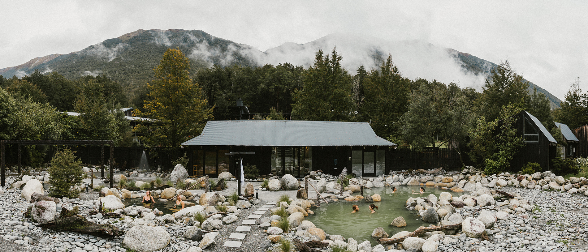
Hanmer Springs: a weekend escape
03 March 2026
A short getaway at Hanmer Springs includes relaxation, indulgence and a touch of adrenaline.
A journey from Queenstown to Christchurch takes in the unique colour and beauty of the South Island.
Driving east from Queenstown felt like we’d been immersed in an oil painting. Earlier, we’d strolled the streets of Arrowtown, past historic cottages with plaques pinned to their picket fences detailing stories of the butchers, bakers and candlestick makers who had once occupied them – and stumbled upon the residence of artist Graham Brinsley.
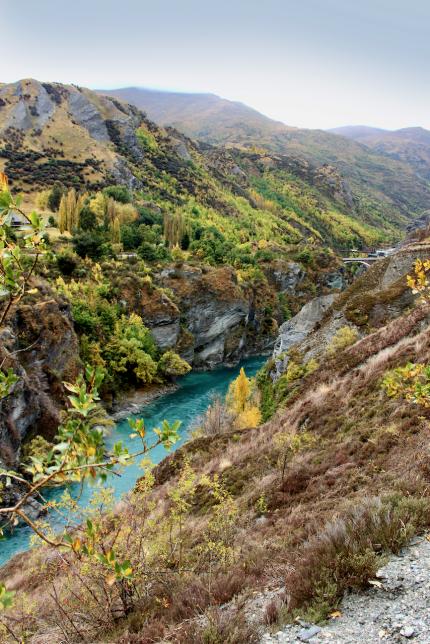
The painter was busy in his studio blotting amber hues onto canvas, each swish of the brush pulling us further into the unfolding scene. Then, later, as we journeyed past Lake Hayes and into the Gibbston Valley wine region, the car window framed an almost identical scene. Deciduous trees threw a chartreuse carpet over deep jade vineyards and burnt ochre hills towered above the striking sapphire glacial waters of the Kawarau River.
We stopped to soak in the beauty and, just as I was considering how cold the river must be, a daring thrill-seeker got very close to finding out, having plunged off the 43-metre-high AJ Hackett Bungy platform on the historic Kawarau Suspension Bridge. This is the world’s first commercial bungy; not stopping to make the leap is a bit like visiting Paris without seeing the Eiffel Tower, however, I was happy just to watch before we drove on.
At the renowned winery, Peregrine, we stepped through the cellar door – with its design based on the wingspan of the peregrine falcon – and spotted an artwork Graham Brinsley. It hung near barrels of the liquid gold harvested from the family-run winery, which has three distinct sub-regions within its landscape Cyclists pedalled along the network of nearby trails, enjoying the scenery at a leisurely pace. We pushed on to Bannockburn, past Roaring Meg – an apt name for the waterway that drives the nearby hydroelectric power station.
The Bannockburn Sluicings site, where the remains of dams, water races, rock tailings and caves left by gold-miners can be explored within an historic reserve, really made an impression on us.
There was more history to experience in Cromwell’s Heritage Precinct, along the bank of the Clutha River. We ordered coffee and fresh baking in a café behind an old stone façade where, according to the original sign, seed and grains were once sold. These lovely buildings date back to the 1860s and were rescued, some even rebuilt on higher ground, when the Clyde Dam flooded Cromwell’s main street in 1990.
Crossing the Otago border into Canterbury at Lindis Pass we saw signs indicating chain fitting bays, reminding us that we were in gnarly terrain. That stretch of road is often closed because of snowfall.
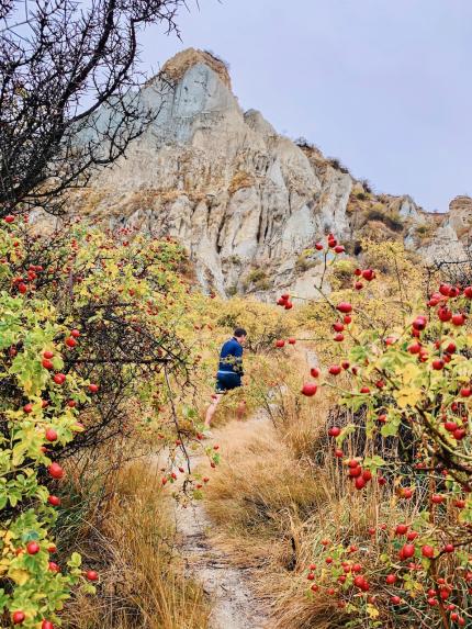
We opted to explore the stalagmite formations of Ōmarama Clay Cliffs, set on private land and accessed by a five-dollar donation. The tall pinnacles and narrow ravines, otherworldly and intriguing, are made up of layers of gravel and silt originally formed by the flow of glaciers more than a million years ago. To me, it felt more like Utah, USA than Waitaki.
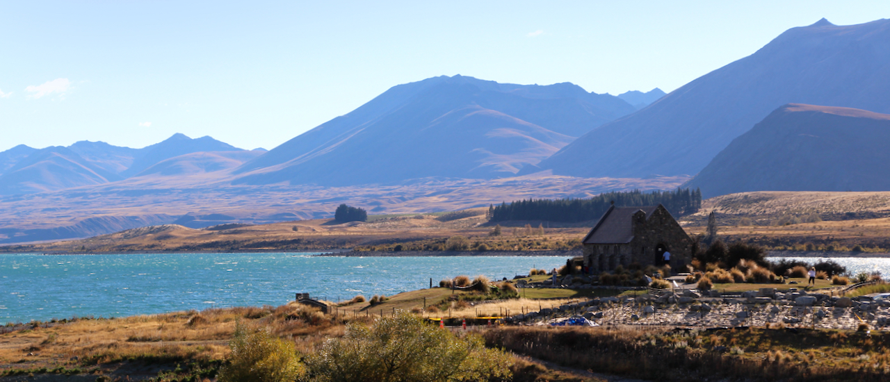
But unmistakable and quintessential Kiwi views came next, across the Waitaki and Mackenzie regions, enjoyed by some while soaking in Hot Tubs Ōmarama. While it would have been the perfect post-walk remedy, we needed to keep going – so continued through Twizel and along the edge of Lake Pūkaki to Tekapō.
What was the rush? We were hoping to see a show. Between March and September is the best time to view the Aurora Australis, the fluorescent pink and green hues that swirl across the night sky as solar winds, reacting with atmospheric gases, create the electrical wonder that is the Southern Lights. And while bungy jumping mightn’t be on my bucket list, witnessing this phenomenon was. Here, in the world’s largest Dark Sky Reserve spanning 4,300 square-kilometres from Aoraki Mt Cook National Park, the villages of Mt Cook, Twizel and Tekapō, is the best place to view the light show.
But it was not to be; the sky was not clear. And what a tease, I thought, as it dawned cloudless the following morning… The silver lining was that we were still surrounded by beauty and had time to photograph the scenes we were travelling through, such as historic Burkes Pass and the rolling countryside into Fairlie, the gateway to the Mackenzie Region.
We quenched our thirst at the home of Barker’s of Geraldine, makers of chutneys, spreads and cordials. The food store, complete with tasting stations highlighting an extensive product range, operates from a corner of the original family farm beside the Te Moana River, where couples ambled hand in hand and families picnicked.
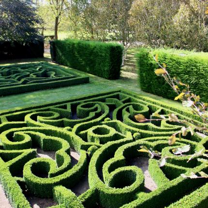
Between the Rangitata and Rākaia Rivers lies Ashburton. Here, we strolled Trott’s Community Garden, bristling with pretty flowers, intricately pruned hedges and a badge of ‘international significance.’ The former privately-owned gardens are now in the hands of a trust; the donation on entry ensures visitors and locals alike can continue to enjoy the soothing and reenergising properties of it.
It’s certainly how we felt as we completed the last leg of the journey to Ōtautahi Christchurch, where more of nature’s benefits await in New Zealand’s own Garden City.
This story is from the Spring 2022 issue of AA Directions magazine.