The magnificent Hooker Valley. © Tourism NZ

Aoraki Mount Cook Village walks


View the map

TAP FOR MORE INFO:

There are several fantastic walks around the village that provide views of Aoraki Mount Cook and the surrounding native alpine bush and area.

Governors Bush Walk

How long will it take? This is a one-hour return walk.

Start this walk at the public shelter at Aoraki Mount Cook Village. It's a delightful bush walk, which joins with Bowen Bush Walk to form a nature trail and explores one of the few stands of silver beech/tawai (also known as tawhai) forest in the park.

A gradual climb leads to a lookout point of Wakefield Ridge and Aoraki Mount Cook. This popular walk offers birdlife, a great view of the mountains and a sheltered place to experience the outdoors in poor weather.

Bowen Bush Walk 

How long will it take? This is a 10-minute return walk (loop track).

This walk starts opposite the petrol pumps on Bowen Drive. It's an easy forest walk that can be joined with Governors Bush Walk to form a nature trail. This track wanders through totara and celery pine/mountain toatoa forest, and has an alternative exit/entry towards the Mount Cook Backpackers. A ‘Bird Song’ sound system enhances the experience.

Glencoe Walk

How long will it take? This is a 30-minute walk.

Start behind the Hermitage Hotel. The walk zigzags through totara trees with a ferny understorey, emerging at a lookout near the prominent water tanks above The Hermitage.

A short climb rewards with a bird’s-eye view of the village and beyond to the white ice of Hooker Glacier and Aoraki Mount Cook. Sunrise and sunset are good times to catch the light-play over the mountains.

Red Tarns Track

How long will it take? This is a two-hour return walk.

Follow the track downhill from the public shelter at Aoraki Mount Cook Village to cross the bridge over Black Birch Stream and then climb steeply to the Red Tarns. The vegetation changes as you ascend from the valley floor to a superb panoramic viewpoint of the valleys below, the village and Aoraki Mount Cook.

The tarns are named from the red pond weed that grows in them. An aptly placed seat allows you to recover your breath and enjoy the views. This is a magnificent spot to view the sunset in summer.

Kea Point TrackKea Point Track. © Graeme Scott Creative Commons


Kea Point Track

How long will it take? This is a two-hour return walk from the village, or a one-hour return walk from the White Horse Hill campground and car park.

Start at the DOC visitor centre on Larch Grove Road and cross over the road to the Hooker valley. The walk gently winds its way through subalpine grasslands and scrub to the Mueller Glacier moraine wall.

The track passes through a landscape that was formed in 1913 when a stream cut through from the glacier to the original Hermitage site, damaging the building. The walk ends at a viewing deck that gives stunning views of Mount Sefton, The Footstool, Hooker valley, Mueller Glacier lake and Aoraki Mount Cook.  

Hooker Valley Swing BridgeHooker Valley Track swing bridge. © Andrea Schaffer Creative Commons

Hooker Valley Track

How long will it take? This is a three-hour return walk (add one hour if starting from the village).

Start across the road at the DOC visitor centre on Larch Grove Road or at White Horse Hill campground and car park on Hooker Valley Road. One of the most popular walks in the park, the track leads up the Hooker valley towards Aoraki Mount Cook. It passes close to the Alpine Memorial (a great viewpoint) and Freda’s Rock before coming to the viewing point of the Mueller Glacier and the first swing bridge.

Cross the Hooker River here and carry on to the second swing bridge.

Look out for many different wildflowers along the way, including celmisia and the Mount Cook buttercup kōpukupuku.

The track from the first swing bridge to the second travels between old moraine ridges and humps. Past the second bridge, the vegetation changes to more open tussock and a wider valley floor. A third swing bridge leads to the East Hooker and the source of the Hooker River. The track ends at the glacier lake, where there are amazing views to be had of Aoraki Mount Cook, Hooker Glacier and the Southern Alps Ka Tiritiri o te Moana.

Return the same way, enjoying more views down the valley and across to the Sealy Range. 

Explore more...

More stories like this

Find out more

Things to do

Aoraki Mount Cook National Park: home to our own Everest

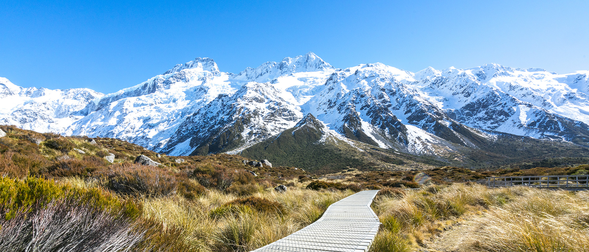
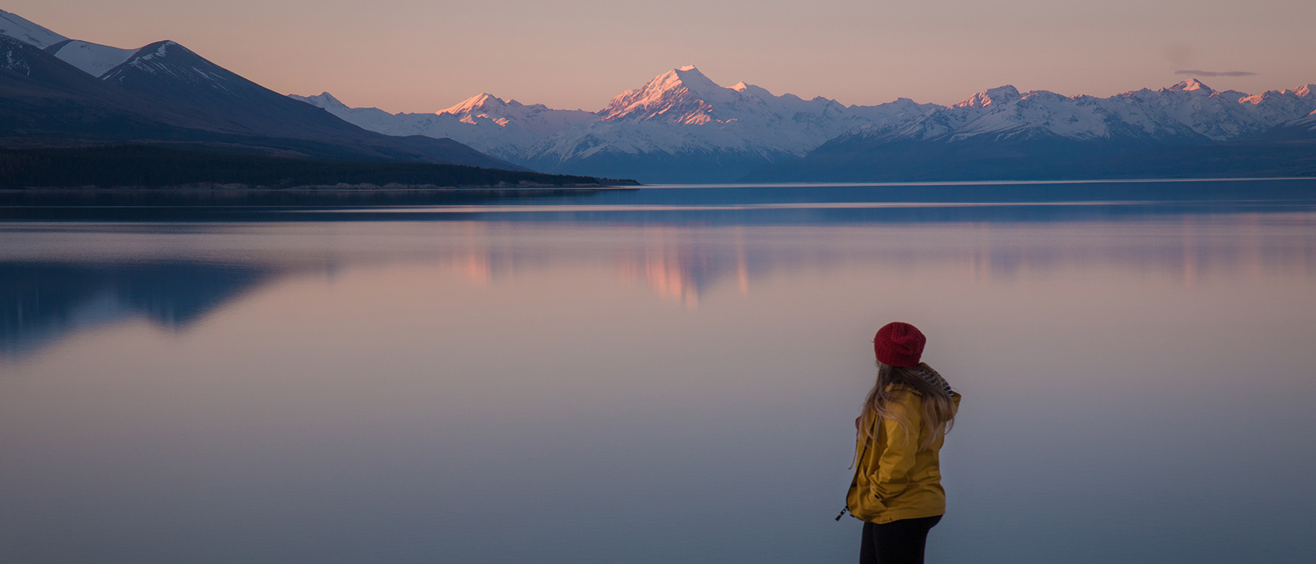
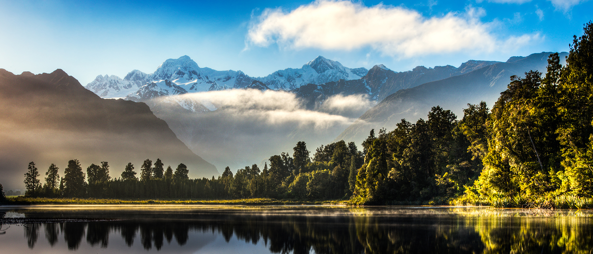
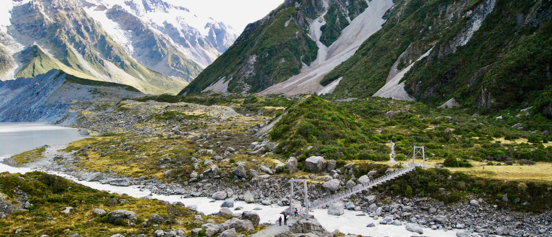
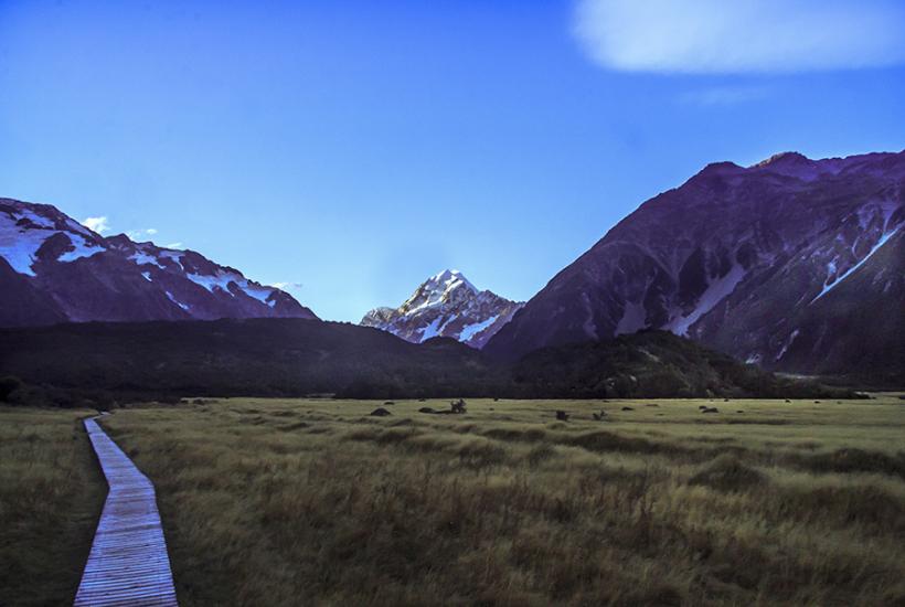
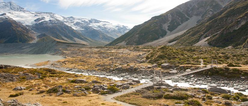
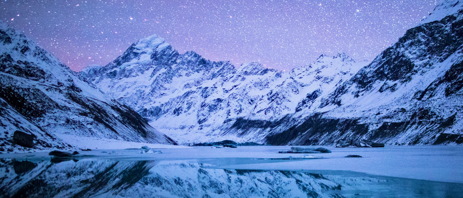
Aoraki Mount Cook National Park is a rugged land of ice and rock, with 19 peaks over 3000 metres, including New Zealand’s highest mountain, Aoraki Mount Cook.  Read the story . . . 

Find out more

Get outdoors

Mackenzie: for lovers

Lording over the Mackenzie region, Aoraki Mount Cook has become a symbol for what could easily win the unofficial 'most beautiful region in New Zealand' competition. Read the story . . . 

Find out more

Get outdoors

Lake Matheson: the perfect mirror

If you find yourself on the West Coast in a reflective mood, you’ll also find you’re in good company. Read the story . . . 

Find out more

Get outdoors

Aoraki Mount Cook National Park: the iconic peak that is the snapshot of the south

Explore snowy mountainscapes, turquoise glacier-fed lakes and the snow tussock grassland of alpine valleys in the Aoraki Mount Cook National Park. Read the story . . . 

AA Members save on selected accommodation with
AA Traveller

AA Members
Book now
Non Members
Book now