Eastland: sun, sand and seclusion
24 February 2026
Take the long way round on State Highway 35, with over 300km of underpopulated coastline ahead, with plenty to do along the way.
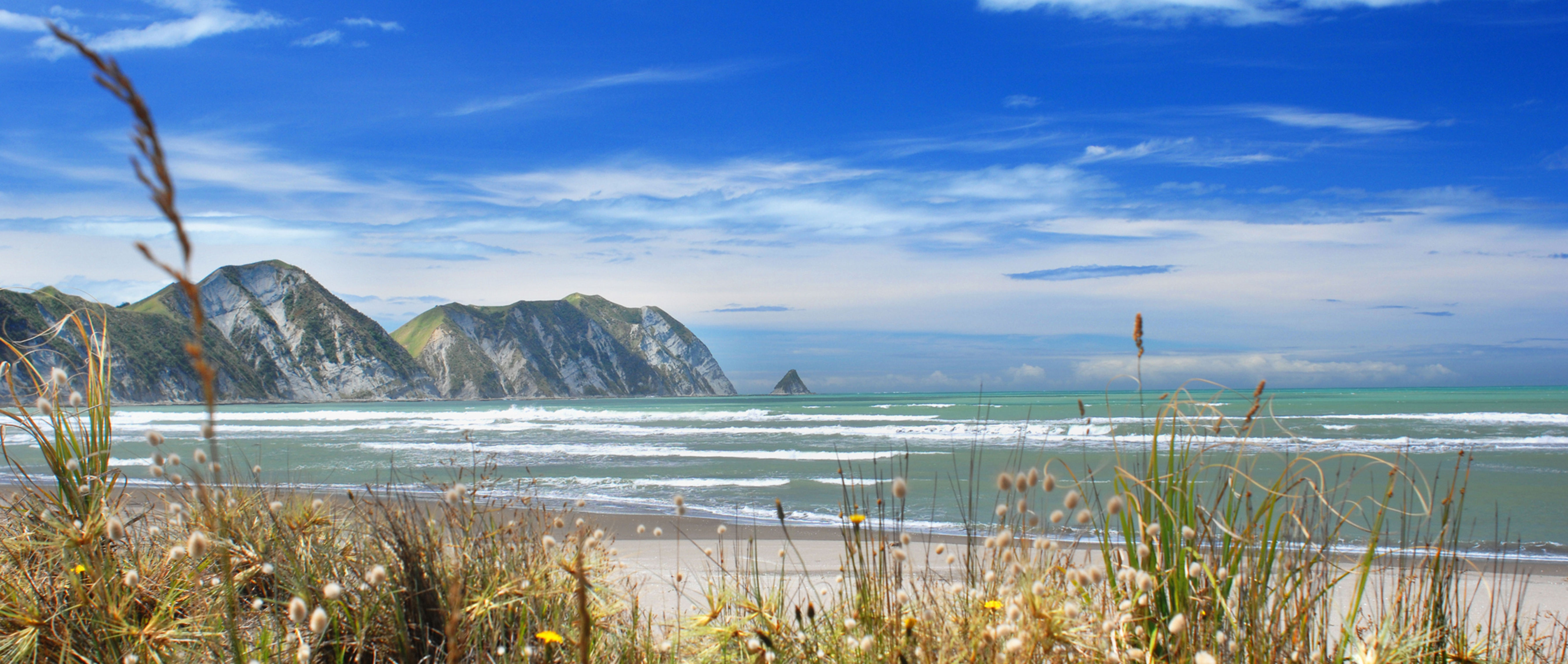
‘Poverty Bay’ is a serious misnomer for this place of plenty, I thought, as I lugged my trug of technicolour fruit and veges from our orchard and garden, hefting it onto the kitchen bench alongside a slab of prime Angus beef and a crayfish dropped off by friends.
Ironically, Poverty Bay is one of the most fertile areas of New Zealand, famous for its luscious chardonnay and its fruit and vegetables, which flourish in the rich, alluvial soils here and in the abundant sunshine. The land is so fertile that when we rip plants out of the garden, they take root again instantly and continue to grow.
The local population has spent the last 247 years rueing the day that Captain James Cook named the region Poverty Bay to reflect the fact he was unable to acquire the provisions he needed.
His encounter with Māori in 1769 when he stepped ashore for the first time on New Zealand Aotearoa soil also left long-lasting scars. When HMS Endeavour sailed into the bay on 7 October 1769, local Māori were mystified by what they saw. They thought the Endeavour was an enormous bird with wings of great size and beauty, and that the longboats were smaller birds and Cook and his men were atua or gods. Cook was eager to make friendly contact, however, a series of unfortunate misunderstandings, both on the day of the landing and on the following day, resulted in the deaths of several Māori.
Initially Cook had planned to call this place Endeavour Bay, but instead, he named it Poverty Bay ‘because it afforded us no one thing we wanted’.
The region has since unofficially adopted the mellifluous Māori name Tairāwhiti, ‘the coast upon which the sun shines across the water’ and the somewhat bland Eastland in place of Poverty Bay.
Apart from holding the distinction of being the first meeting place on New Zealand Aotearoa soil between Māori and European, Tairāwhiti is a place of many other notable firsts.
Gisborne, the most easterly city in the world, is the first city on the planet to see the light of each new day; it’s where Māori landed their voyaging waka in the 14th century after navigating the Pacific Ocean; it’s home to Millton Vineyards and Winery, the first producer in New Zealand to gain Bio-Gro certification for organic wine production in 1989; and it's also home to Rocket Lab, the world’s first privately-owned rocket launch facility that recently put its first test rocket into space from a base on the tip of Māhia Peninsula.
Surfers know the coastline for its world-class surf breaks; cyclists for the Motu Trails offering everything from easy, family-friendly pathways to seriously challenging backcountry tracks; hikers for the myriad short and multi-day scenic walks; music-lovers for Rhythm and Vines held over New Year; epicureans for the Gisborne Wine & Food Weekend and vintage steam train enthusiasts for Wa165, the only engine of its class still operating in New Zealand (and incidentally the only railway line in the southern hemisphere that crosses an airport runway).
In Gisborne, planes give way to trains.
Add to that the fact that Tairāwhiti is the country’s biggest citrus grower, the self-proclaimed ‘Chardonnay capital of the World’ and one of the largest horticultural suppliers in New Zealand and the region’s credentials are impressive... but sit largely under the radar. There’s a modesty here which Māori speak of in a well-known proverb or whakataukī.
Kāore te kūmara e kōrero mō tōna ake reka. The kūmara (sweet potato) does not speak of his own sweetness.
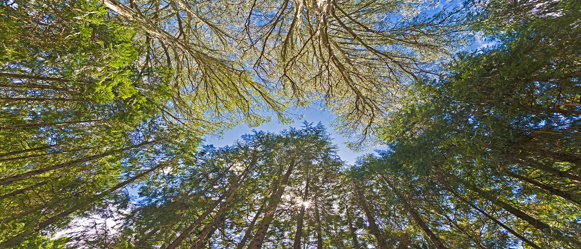
Lake Waikaremoana in Te Urewera National Park is just two hours’ drive from Gisborne but feels like another enchanted world.
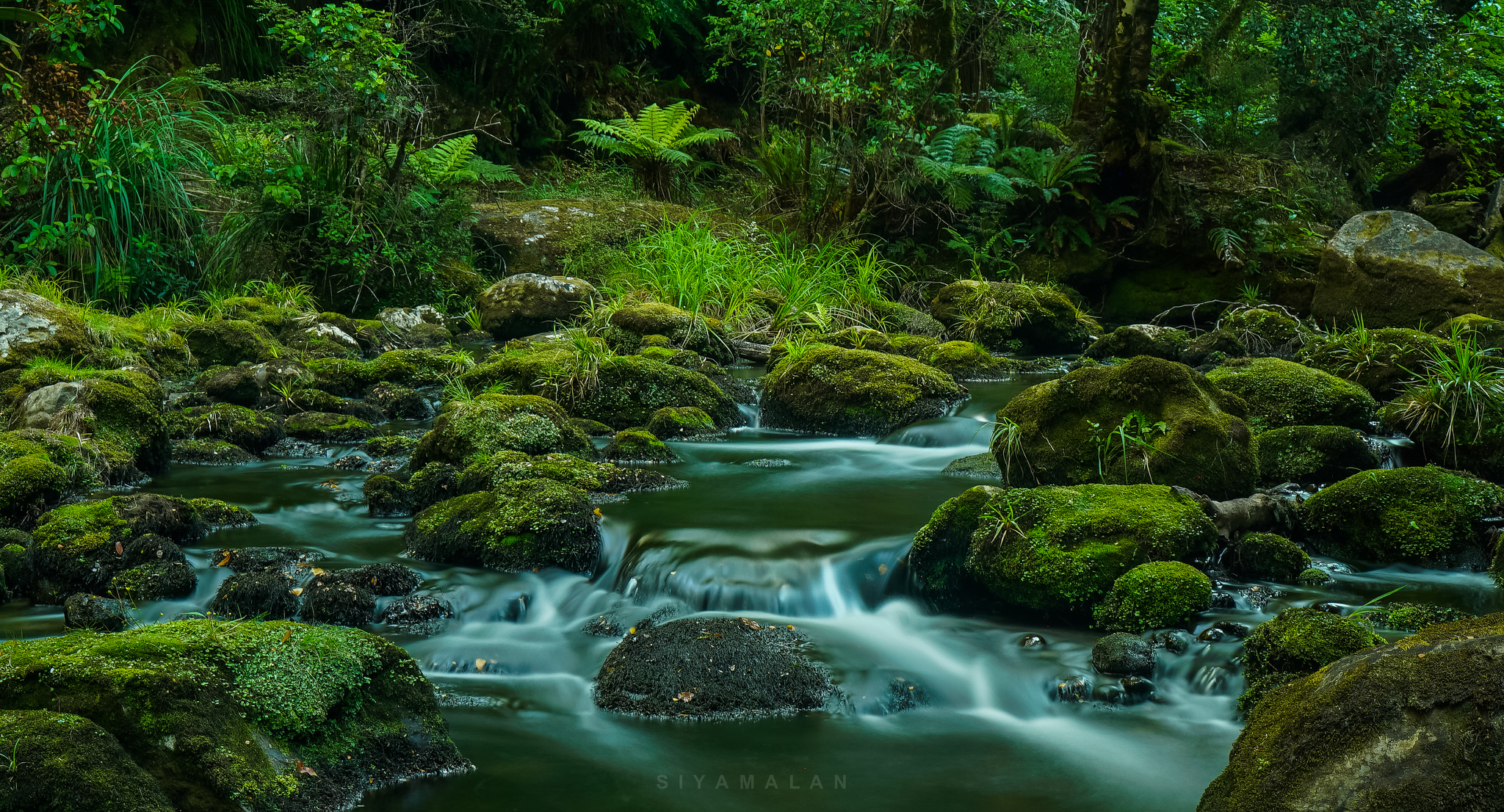
This ancestral home of Ngāi Tūhoe, the ‘Children of the Mist’, is a land of legends and mystique. Over the years we’ve explored many sections of the spectacular 46km Great Walk that links a series of pristine beaches meandering up and down through forests of giant podocarp trees. There’s an absence of sharp shapes in the forest, where everything is draped in soft moss and sparkling with diamantes after the rain.
Sunshine, filtered through leaves and ferns, is soft and mottled, as soothing to the eye as the cool air is to the skin. Apart from the muffled footfall of our boots on soft leaf litter, the only sounds are those of nature’s repertoire... gurgling streams, thunderous waterfalls and birdsong so sweet and sharp and joyful it brings tears to my eyes.
Our standard itinerary at the lake includes hiking, boating, picnicking, swimming, fishing, kayaking and water-skiing. When feeling energetic, we tackle the 1180m Panekiri Bluff with its breathtaking vistas of the ink-blue lake, encircled on all sides by dark green rainforest.
But our favourite walk is the 30-minute side track to Korokoro Falls where you can edge your way along a ledge and stand behind the waterfall. Yes, you do get wet, but it’s pure magic looking through a waterfall and a massive shot of negative ions!
Most people go to Mōrere Springs Scenic Reserve to enjoy the lovely hot pools surrounded by native forest but before we ‘take the water’, we torture ourselves on the Mangakawa Walkway.
It’s great exercise with a series of steep, seemingly endless steps winding their way to the top of the ridge high above the pools below. Being blessed with short legs, I have to use my tramping stick to push myself up some of the tallest steps, which are like small cliffs. It’s the perfect spot on a hot day, in the dappled shade of stunning virgin rainforest (as well as a haven for native bird-life), alongside the pretty Mangakawa Stream.
You can learn how early Māori used nīkau palm leaves for thatching, basket-making, floor mats and wrapping food for cooking along the walk, as well as the names of many other trees in the forest.
Negotiating your way around the massive boulders in the stream bed can provide an element of adventure for those who don’t find the exquisite natural environment enough of a thrill.
It’s also fascinating to see the source of the hot springs: the track takes you past a pond where the hot water bubbles up and is piped to the pools below.
Described by the Department of Conservation as ‘among the most diverse and beautiful of New Zealand’s short bushwalks’, the loop track is physically challenging but easily managed in two hours if you have a reasonable level of fitness; an hour and a half if you don’t stop all the time to take photographs and read every information panel like me.
At the end of the tramp, you can dump your pack, peel off your sticky gear and luxuriate in a refreshingly cool, outdoor pool. Or, if it’s a cold day, soak your complaining muscles in one of the hot mineral pools at the springs where the track begins and ends.
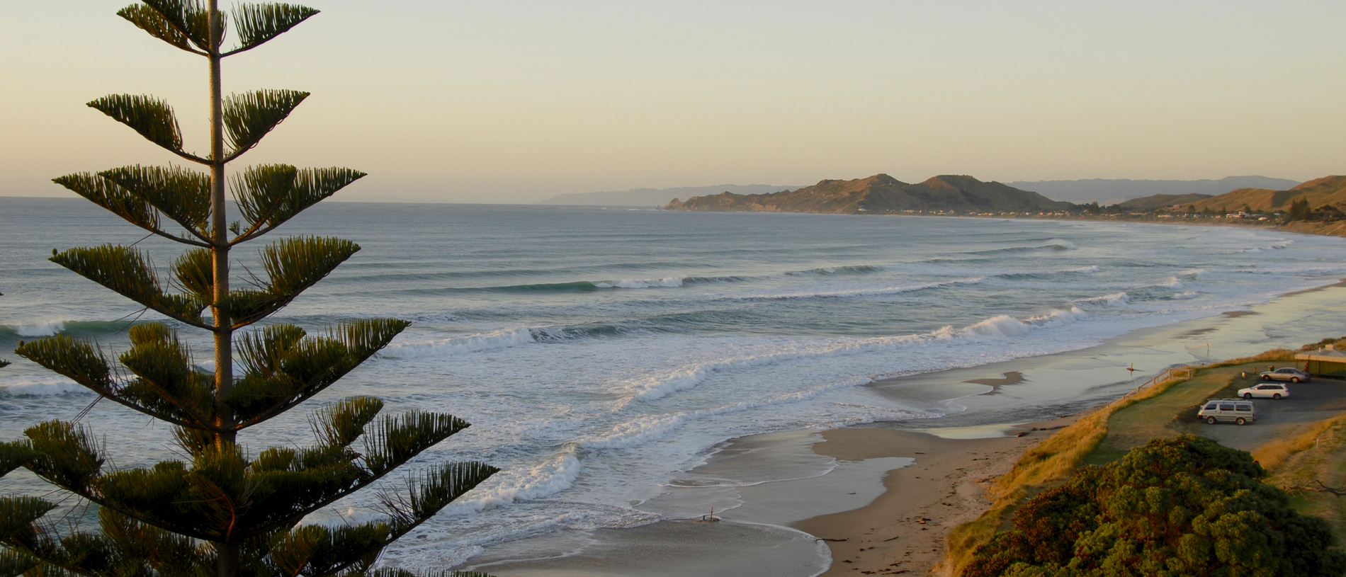
Māhia Beach, 106km south of Gisborne, has been an idyllic Kiwi holiday destination for decades, a place families return to year after year. Known for its superb fishing, diving and surfing, Māhia hit the headlines in 2007 when Moko, the bottlenose dolphin, took up residence in the bay for a couple of years before moving north to Gisborne. He was a real and enchanting entertainer who inspired an outbreak of ‘Moko-mania’ in the locals.
A tiny settlement of around 850 people that swells to thousands in the summer, it's expected that the quiet life will be a thing of the past once Rocket Lab begins launching commercial rockets into space from its base at Onenui Station at the tip of Māhia Peninsula. It is the first privately-owned launch pad in the world to put commercial satellites into space and heralds a new era for the region.
Why choose Māhia Peninsula as a site to launch rockets? Rocket Lab founder Peter Beck says this remote part of New Zealand has some of the clearest, least-crowded airspace on the planet and its extreme easterly location offers the greatest number of launch angles in the world. Beck, a Kiwi, inspected many locations before deciding on Māhia which he calls ‘the most beautiful launch site on earth’.
Scrambling to the top of Rahuimokairoa, the 397m hill at the end of Māhia Beach to watch the sunrise over the Pacific, has long been a ritual for visitors to the area. As we sit in the long grass at the summit, it seems bizarre to think of rockets thundering into space from such a peaceful location.
We are privileged to live in an area rich in Māoritanga – Māori culture, traditions and way of life – and manaakitanga, hospitality. With nearly 50 percent of the population of Māori descent, the highest proportion in New Zealand, there is no better place than Tairawhiti to immerse yourself in the language, history, music, dance and legends of the tangata whenua, the people of the land.
Two hours’ drive (130km) north of Gisborne, Hikurangi, the sacred maunga or mountain of the Ngāti Porou iwi, is the first peak in the world to be touched by the rays of the rising sun of each new dawn. It’s the resting place of Māui-Tikitiki-a-Taranga, the famous Māori and Polynesian demi-god, who lifted Hikurangi out of the ocean when he fished up Te Ika-a-Māui, the North Island. According to Ngāti Porou, Māui’s waka Nukutaimemeha lies in Takawhiti, the lake near the summit.
To celebrate the dawning of the new millennium ‘Te Takapau a Māui’, a series of nine huge whakairo (carved art works), were commissioned for the maunga representing Māui and his descendants. These impressive pou are among Aotearoa’s most significant works of art.
You can take a guided four-wheel-drive tour or tramp to the top of the mountain. Find out more from Tourism Ngāti Porou.